Long Pond fishing map is available as part of iBoating : USA Marine & Fishing App(now supported on multiple platforms including Android, iPhone/iPad, MacBook, and Windows(tablet and phone)/PC based chartplotter.).
With our Lake Maps App, you get all the great marine chart app features like fishing spots, along with Long Pond depth map. The fishing maps app include HD lake depth contours, along with advanced features found in Fish Finder / Gps Chart Plotter systems, turning your device into a Depth Finder. The Long Pond Navigation App provides advanced features of a Marine Chartplotter including adjusting water level offset and custom depth shading. Fishing spots and depth contours layers are available in most Lake maps. Lake navigation features include advanced instrumentation to gather wind speed direction, water temperature, water depth, and accurate GPS with AIS receivers(using NMEA over TCP/UDP). Autopilot support can be enabled during ‘Goto WayPoint’ and ‘Route Assistance’.
Now i-Boating supports Fishing Points in Long Pond.
Have more questions about the Nautical Chart App? Ask us.
Fishing Info for Long Pond
Long Pond is a 211-acre (0.85 km2) cold water pond in Plymouth, Massachusetts, east of Myles Standish State Forest, Halfway Pond and Round Pond, west of Route 3 at Exit 3 and The Pinehills, northwest of Bloody Pond, and north of West Wind Shores. The pond has an average depth of 46 feet (14 m) and a maximum depth of 100 feet (30 m). It is fed by groundwater and an inlet from Little Long Pond, and drains through the pond bottom. A paved boat ramp provided by the Public Access Board with ample parking spaces is easily accessible from Route 3. The Pond has a 50 hp limitation on boating.
More on Wikipedia...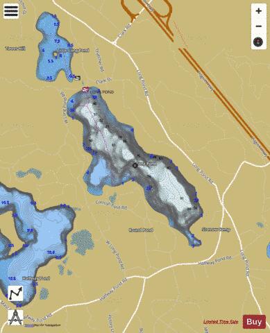
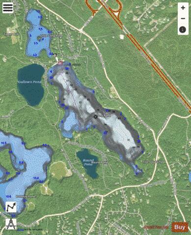
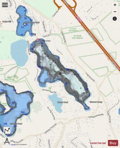
Long Pond Fishing Map Stats | |
| Title | Long Pond |
| Scale | 1:3000 |
| Counties | Plymouth |
| Nearby Cities | The Pinehills, White Island Shores, White Horse Beach, Sagamore, Buzzards Bay, Plymouth, Bourne, Onset, North Plymouth, Monument Beach |
| Area * | 208.30 acres |
| Shoreline * | 3.37 miles |
| Min Longitude | -70.61 |
| Min Latitude | 41.85 |
| Max Longitude | -70.59 |
| Max Latitude | 41.87 |
| Edition Label 1 | |
| Edition Label 2 | |
| Edition Label 3 | |
| Id | US_CC_MA_00616315 |
| Country | US |
| Projection | Mercator |
| * some Stats may include nearby/connecting waterbodies | |
|