Wequaquet Lake fishing map is available as part of iBoating : USA Marine & Fishing App(now supported on multiple platforms including Android, iPhone/iPad, MacBook, and Windows(tablet and phone)/PC based chartplotter.).
With our Lake Maps App, you get all the great marine chart app features like fishing spots, along with Wequaquet Lake depth map. The fishing maps app include HD lake depth contours, along with advanced features found in Fish Finder / Gps Chart Plotter systems, turning your device into a Depth Finder. The Wequaquet Lake Navigation App provides advanced features of a Marine Chartplotter including adjusting water level offset and custom depth shading. Fishing spots and depth contours layers are available in most Lake maps. Lake navigation features include advanced instrumentation to gather wind speed direction, water temperature, water depth, and accurate GPS with AIS receivers(using NMEA over TCP/UDP). Autopilot support can be enabled during ‘Goto WayPoint’ and ‘Route Assistance’.
Now i-Boating supports Fishing Points in Wequaquet Lake.
Have more questions about the Nautical Chart App? Ask us.
Fishing Info for Wequaquet Lake
Wequaquet Lake is a 654 acres (265 ha) unstratified warmwater lake in Barnstable County, Massachusetts. It is located northwest of Hyannis. Wequaquet Lake drains south via Centerville River which flows into the Atlantic Ocean. Wequaquet Lake is also known as Chequaquet Lake, Great Pond or Nine Mile Pond. The bottom is composed primarily of sand. The 7.5 miles of shoreline is heavily (90%) developed with cottages and year-round homes. is connected to Wequaquet Lake by a narrow channel, other nearby ponds include and .
More on Wikipedia...Popular fish species in this lake include American eel, Brown bullhead, Chain pickerel, Golden shiner, Largemouth bass, Pumpkinseed, White sucker and Yellow perch.
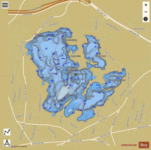
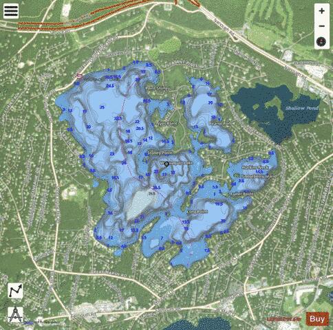
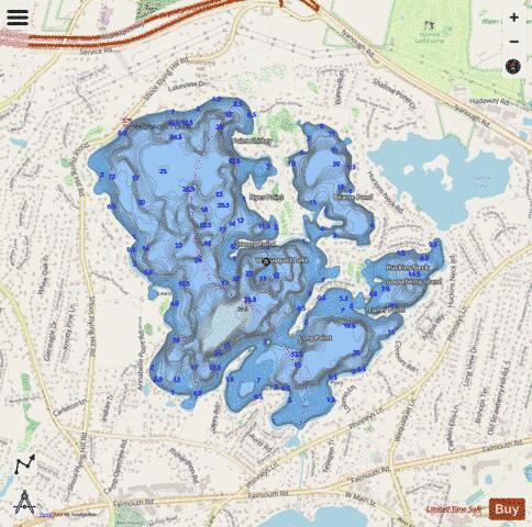
Wequaquet Lake Fishing Map Stats | |
| Title | Wequaquet Lake |
| Sailing Clubs in this Chart region | |
| Wequaquet Lake Yacht Club | |
| Scale | 1:6000 |
| Counties | Barnstable |
| Nearby Cities | Centerville, West Barnstable, Barnstable, Hyannis, Osterville, Marstons Mills, Yarmouth Port, West Yarmouth, Yarmouth, Cotuit |
| Area * | 636.58 acres |
| Shoreline * | 11.24 miles |
| Min Longitude | -70.35 |
| Min Latitude | 41.66 |
| Max Longitude | -70.32 |
| Max Latitude | 41.68 |
| Edition Label 1 | |
| Edition Label 2 | |
| Edition Label 3 | |
| Id | US_CC_MA_00615799 |
| Country | US |
| Projection | Mercator |
| * some Stats may include nearby/connecting waterbodies | |
|