Snipatuit Pond fishing map is available as part of iBoating : USA Marine & Fishing App(now supported on multiple platforms including Android, iPhone/iPad, MacBook, and Windows(tablet and phone)/PC based chartplotter.).
With our Lake Maps App, you get all the great marine chart app features like fishing spots, along with Snipatuit Pond depth map. The fishing maps app include HD lake depth contours, along with advanced features found in Fish Finder / Gps Chart Plotter systems, turning your device into a Depth Finder. The Snipatuit Pond Navigation App provides advanced features of a Marine Chartplotter including adjusting water level offset and custom depth shading. Fishing spots and depth contours layers are available in most Lake maps. Lake navigation features include advanced instrumentation to gather wind speed direction, water temperature, water depth, and accurate GPS with AIS receivers(using NMEA over TCP/UDP). Autopilot support can be enabled during ‘Goto WayPoint’ and ‘Route Assistance’.
Now i-Boating supports Fishing Points in Snipatuit Pond.
Have more questions about the Nautical Chart App? Ask us.
Fishing Info for Snipatuit Pond
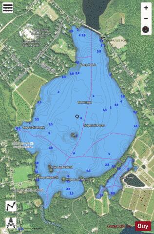
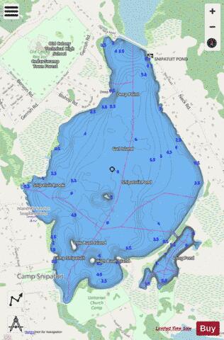
Snipatuit Pond is a shallow 710-acre (2.9 km2) warm water pond in Rochester, Massachusetts. The average depth is five feet and the maximum depth is six feet, except for one very small nine foot hole near the pump station on the west shore. The pond is the headwaters of the Mattapoisett River. The inflow comes from two sources: Cedar Swamp, which is located to the northeast, and Great Quittacas Pond, which is connected to Snipatuit Pond and located to the northwest. The water quality is impaired due to wetlands vegetation. The boat access to the pond is a dirt ramp with limited parking located off Neck Road. Shoreline access is limited to the area east of the pond bordering Neck Road.
More on Wikipedia...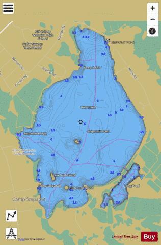
Snipatuit Pond Fishing Map Stats | |
| Title | Snipatuit Pond |
| Scale | 1:6000 |
| Counties | Plymouth |
| Nearby Cities | Rochester, Acushnet, West Wareham, Lakeville, Marion, Mattapoisett, Middleborough, Fairhaven, Wareham, Carver |
| Area * | 676.56 acres |
| Shoreline * | 7.18 miles |
| Min Longitude | -70.87 |
| Min Latitude | 41.76 |
| Max Longitude | -70.85 |
| Max Latitude | 41.79 |
| Edition Label 1 | |
| Edition Label 2 | |
| Edition Label 3 | |
| Id | US_CC_MA_00614484 |
| Country | US |
| Projection | Mercator |
| * some Stats may include nearby/connecting waterbodies | |
|