Jamaica Pond fishing map is available as part of iBoating : USA Marine & Fishing App(now supported on multiple platforms including Android, iPhone/iPad, MacBook, and Windows(tablet and phone)/PC based chartplotter.).
With our Lake Maps App, you get all the great marine chart app features like fishing spots, along with Jamaica Pond depth map. The fishing maps app include HD lake depth contours, along with advanced features found in Fish Finder / Gps Chart Plotter systems, turning your device into a Depth Finder. The Jamaica Pond Navigation App provides advanced features of a Marine Chartplotter including adjusting water level offset and custom depth shading. Fishing spots and depth contours layers are available in most Lake maps. Lake navigation features include advanced instrumentation to gather wind speed direction, water temperature, water depth, and accurate GPS with AIS receivers(using NMEA over TCP/UDP). Autopilot support can be enabled during ‘Goto WayPoint’ and ‘Route Assistance’.
Now i-Boating supports Fishing Points in Jamaica Pond.
Have more questions about the Nautical Chart App? Ask us.
Fishing Info for Jamaica Pond
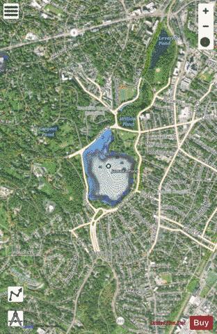
Jamaica Pond is a kettle lake, part of the Emerald Necklace of parks in Boston designed by Frederick Law Olmsted. The pond and park are in the Jamaica Plain neighborhood of Boston, close to the border of Brookline. It is the source of the Muddy River, which drains into the lower Charles River.USGS 2005 The pond has an area of about 68 acres (28 ha), and is 53 feet (16 m) deep at its center (MassWildlife map), making it the largest body of fresh water in Boston, and the largest natural freshwater body in the lower Charles River watershed. It is ringed by a 1.5 miles (2.4 km) walking path, and is an extremely popular destination for Bostonians for walking, fishing, rowing, and sailing. Around Halloween each year, the pond serves as the site for The Lantern Parade. Participants dress in their Halloween costumes and walk around the pond. The pond once served as a reservoir for the City of Boston and the Town of West Roxbury, and it supplied ice in the winter to Boston and beyond. According to the USGS, the name Jamaica derives from an Indian name meaning "abundance of beavers".
More on Wikipedia...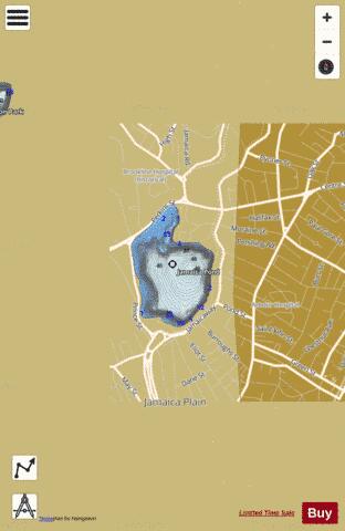
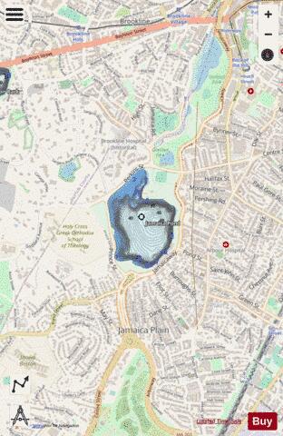
Jamaica Pond Fishing Map Stats | |
| Title | Jamaica Pond |
| Scale | 1:3000 |
| Counties | Suffolk |
| Nearby Cities | Brookline, Cambridge, Somerville, Boston, Watertown, Milton, Dedham, Newton, Belmont, Medford |
| Area * | 66.74 acres |
| Shoreline * | 1.41 miles |
| Min Longitude | -71.12 |
| Min Latitude | 42.31 |
| Max Longitude | -71.12 |
| Max Latitude | 42.32 |
| Edition Label 1 | |
| Edition Label 2 | |
| Edition Label 3 | |
| Id | US_CC_MA_00612944 |
| Country | US |
| Projection | Mercator |
| * some Stats may include nearby/connecting waterbodies | |
|