Folsom lake fishing map is available as part of iBoating : USA Marine & Fishing App(now supported on multiple platforms including Android, iPhone/iPad, MacBook, and Windows(tablet and phone)/PC based chartplotter.).
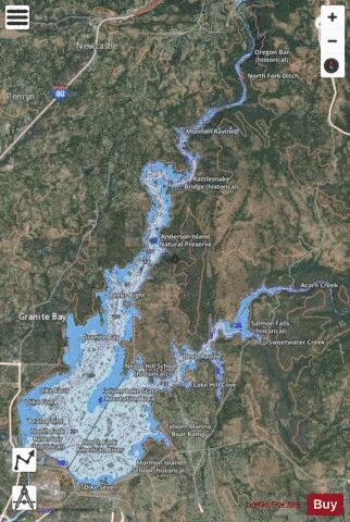
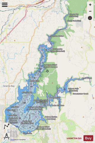
With our Lake Maps App, you get all the great marine chart app features like fishing spots, along with Folsom lake depth map. The fishing maps app include HD lake depth contours, along with advanced features found in Fish Finder / Gps Chart Plotter systems, turning your device into a Depth Finder. The Folsom lake Navigation App provides advanced features of a Marine Chartplotter including adjusting water level offset and custom depth shading. Fishing spots and depth contours layers are available in most Lake maps. Lake navigation features include advanced instrumentation to gather wind speed direction, water temperature, water depth, and accurate GPS with AIS receivers(using NMEA over TCP/UDP). Autopilot support can be enabled during ‘Goto WayPoint’ and ‘Route Assistance’.
Now i-Boating supports Fishing Points in Folsom lake.
Have more questions about the Nautical Chart App? Ask us.
Fishing Info for Folsom lake
Folsom Lake is a reservoir on the American River in the Sierra Nevada foothills of California, United States. It is located within Placer, El Dorado, and Sacramento Counties. It is about 25 mi (40 km) northeast of Sacramento. The lake surface area is 11,500 acres (4,700 ha), its elevation is 466 ft (142 m), and it has 75 mi (121 km) of undulated shoreline. Folsom Lake with its surrounding Folsom Lake State Recreation Area is one of the most visited parks in the California park system. The California Office of Environmental Health Hazard Assessment has developed a safe eating advisory for Folsom Lake based on levels of mercury found in fish caught here.
More on Wikipedia...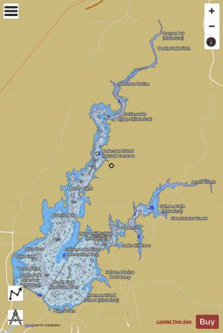
Folsom lake Fishing Map Stats | |
| Title | Folsom lake |
| Sailing Clubs in this Chart region | |
| Folsom Lake Yacht Club | |
| Scale | 1:6000 |
| Counties | El Dorado, Placer, Sacramento |
| Nearby Cities | Granite Bay, El Dorado Hills, Auburn, Folsom, Pilot Hill, Newcastle, Orangevale, Penryn, Loomis, Rocklin |
| Area * | 11090.48 acres |
| Shoreline * | 96.34 miles |
| Min Longitude | -121.17 |
| Min Latitude | 38.69 |
| Max Longitude | -121.01 |
| Max Latitude | 38.87 |
| Edition Label 1 | |
| Edition Label 2 | |
| Edition Label 3 | |
| Id | US_CA_folsomlake |
| Country | US |
| Projection | Mercator |
| * some Stats may include nearby/connecting waterbodies | |
|