Wilson Lake fishing map is available as part of iBoating : USA Marine & Fishing App(now supported on multiple platforms including Android, iPhone/iPad, MacBook, and Windows(tablet and phone)/PC based chartplotter.).
With our Lake Maps App, you get all the great marine chart app features like fishing spots, along with Wilson Lake depth map. The fishing maps app include HD lake depth contours, along with advanced features found in Fish Finder / Gps Chart Plotter systems, turning your device into a Depth Finder. The Wilson Lake Navigation App provides advanced features of a Marine Chartplotter including adjusting water level offset and custom depth shading. Fishing spots and depth contours layers are available in most Lake maps. Lake navigation features include advanced instrumentation to gather wind speed direction, water temperature, water depth, and accurate GPS with AIS receivers(using NMEA over TCP/UDP). Autopilot support can be enabled during ‘Goto WayPoint’ and ‘Route Assistance’.
Now i-Boating supports Fishing Points in Wilson Lake.
Have more questions about the Nautical Chart App? Ask us.
Fishing Info for Wilson Lake
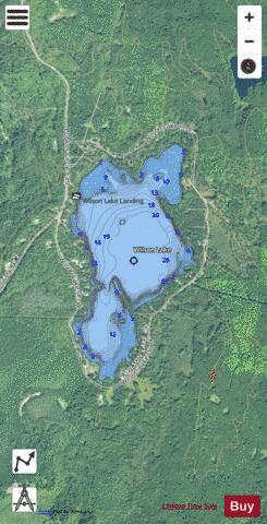
Wilson Lake is located in Iron County, outside of Wilson Creek Flowage. It is one of seven lakes in the state with the name Wilson Lake. This particular lake is a popular fishing lake 5 miles (8.0 km) from the town of Mercer. With three bays, it has two islands and water feed and drain in the South Bay of the lake. The public boat landing is in the Main Bay on the west side of the lake. The North Bay has the most marsh vegetation. There are many cabins located on the lake for residents and vacationers to the North Woods.
More on Wikipedia...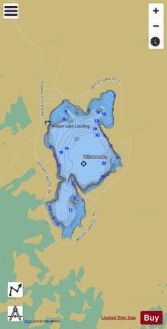
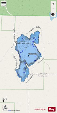
Wilson Lake Fishing Map Stats | |
| Title | Wilson Lake |
| Scale | 1:3000 |
| Counties | Iron |
| Nearby Cities | Mercer, Manitowish, Manitowish Waters, Winchester, Lac du Flambeau, Van Buskirk, Pence, Montreal, Hurley, Ironwood |
| Area * | 155.32 acres |
| Shoreline * | 3.04 miles |
| Min Longitude | -90.12 |
| Min Latitude | 46.11 |
| Max Longitude | -90.11 |
| Max Latitude | 46.12 |
| Edition Label 1 | |
| Edition Label 2 | |
| Edition Label 3 | |
| Id | US_AA_WI_wilson_lake_wi |
| Country | US |
| Projection | Mercator |
| * some Stats may include nearby/connecting waterbodies | |
|