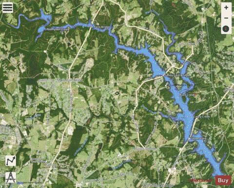
Lake Blalock / Pacolet River fishing map is available as part of iBoating : USA Marine & Fishing App(now supported on multiple platforms including Android, iPhone/iPad, MacBook, and Windows(tablet and phone)/PC based chartplotter.).
With our Lake Maps App, you get all the great marine chart app features like fishing spots, along with Lake Blalock / Pacolet River depth map. The fishing maps app include HD lake depth contours, along with advanced features found in Fish Finder / Gps Chart Plotter systems, turning your device into a Depth Finder. The Lake Blalock / Pacolet River Navigation App provides advanced features of a Marine Chartplotter including adjusting water level offset and custom depth shading. Fishing spots and depth contours layers are available in most Lake maps. Lake navigation features include advanced instrumentation to gather wind speed direction, water temperature, water depth, and accurate GPS with AIS receivers(using NMEA over TCP/UDP). Autopilot support can be enabled during ‘Goto WayPoint’ and ‘Route Assistance’.
Now i-Boating supports Fishing Points in Lake Blalock / Pacolet River.
Have more questions about the Nautical Chart App? Ask us.
Fishing Info for Lake Blalock / Pacolet River
Lake Blalock (formally, the H. Taylor Blalock Reservoir) is a reservoir in Spartanburg County, South Carolina, located on the Pacolet River about five miles north of Spartanburg. After its creation was authorized in 1976 by the Commissioners of Spartanburg Water System, Blalock Dam was constructed in 1983. The existing earthen dam is approximately 700 ft (210 m). long and 70 ft (21 m) high. It was originally designed for a normal operating pool of 700 feet (210 m), and the lake had approximately 35 miles (56 km) of shoreline. The existing spillway has a crest length of 270 ft (82 m). To increase the safe yield of the reservoir, Spartanburg Water System raised the level of Lake Blalock by 10 feet (3.0 m), increasing the water surface elevation to 710 feet (220 m) in 2004. This project was completed in 2006 and involved overlaying the existing earthen dam with a layer of roller compacted concrete, approximately 3 ft (0.91 m) in thickness, and constructing a new RCC stilling basin. The existing spillway was also upgraded by furnishing and installing three hydraulically operated spillway crest gates, constructing a new cast-in-place concrete ogee crest, and constructing a bridge across the spillway. In addition, the project also cleared approximately 300 acres (42 miles of shoreline) around the perimeter of the reservoir.
More on Wikipedia...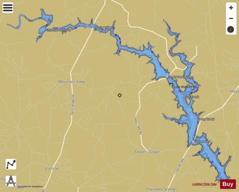
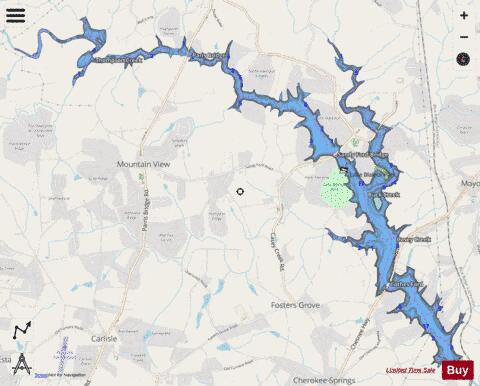
Lake Blalock / Pacolet River Fishing Map Stats | |
| Title | Lake Blalock / Pacolet River |
| Scale | 1:6000 |
| Counties | Spartanburg |
| Nearby Cities | Mayo, Chesnee, Fingerville, Boiling Springs, Converse, Cowpens, Clifton, Valley Falls, Glendale, Spartanburg |
| Area * | 1048.85 acres |
| Shoreline * | 36.91 miles |
| Min Longitude | -81.96 |
| Min Latitude | 35.05 |
| Max Longitude | -81.86 |
| Max Latitude | 35.11 |
| Edition Label 1 | |
| Edition Label 2 | |
| Edition Label 3 | |
| Id | US_AA_SC_lakeblalock |
| Country | US |
| Projection | Mercator |
| * some Stats may include nearby/connecting waterbodies | |
|