Queechy Lake fishing map is available as part of iBoating : USA Marine & Fishing App(now supported on multiple platforms including Android, iPhone/iPad, MacBook, and Windows(tablet and phone)/PC based chartplotter.).
With our Lake Maps App, you get all the great marine chart app features like fishing spots, along with Queechy Lake depth map. The fishing maps app include HD lake depth contours, along with advanced features found in Fish Finder / Gps Chart Plotter systems, turning your device into a Depth Finder. The Queechy Lake Navigation App provides advanced features of a Marine Chartplotter including adjusting water level offset and custom depth shading. Fishing spots and depth contours layers are available in most Lake maps. Lake navigation features include advanced instrumentation to gather wind speed direction, water temperature, water depth, and accurate GPS with AIS receivers(using NMEA over TCP/UDP). Autopilot support can be enabled during ‘Goto WayPoint’ and ‘Route Assistance’.
Now i-Boating supports Fishing Points in Queechy Lake.
Have more questions about the Nautical Chart App? Ask us.
Fishing Info for Queechy Lake
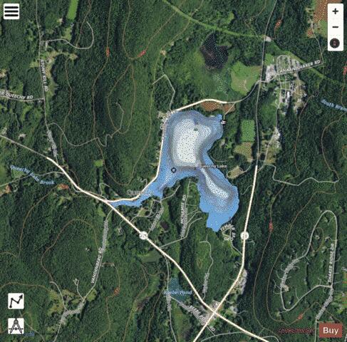
Queechy Lake is a lake in Canaan, Columbia County, New York. Situated near the Massachusetts state border, the lake is 40 feet (12 m) deep and contains a surface area of 141 acres (0.57 km2). The name comes from the Native American Mahican name Quis-sich-kook, of unknown meaning. The lake is located near two major roads, New York State Route 295 and New York State Route 22. Among the present fish species are brown bullhead, brown trout,, smallmouth bass, chain pickerel, pumpkinseed, bluegill, rock bass, rainbow trout, black crappie and yellow perch. Queechy Lake is a natural body of water; however, sometime prior to 1910, the water levels were raised as a result of the construction of a dam along the Stony Kill, a tributary of Queechy Lake. The purpose of the dam was to store water that would supply mills located downstream. In the early 19th century, a summer of dry weather contributed to decreased water levels, which exposed a muddy surface at the lower end of the lake.
More on Wikipedia...Popular fish species in this lake include Black crappie, Brown bullhead, Chain pickerel, Pumpkinseed, Rainbow trout, Rock bass, Smallmouth bass and Yellow perch.
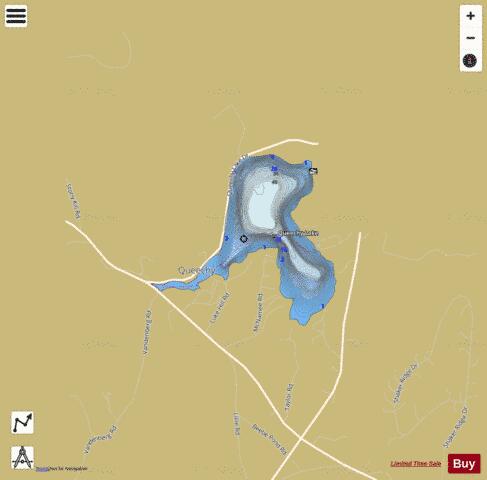
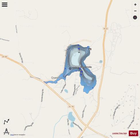
Queechy Lake Fishing Map Stats | |
| Title | Queechy Lake |
| Scale | 1:6000 |
| Counties | Columbia |
| Nearby Cities | Canaan, Richmond, New Lebanon, West Stockbridge, Austerlitz, East Nassau, Lenox, Stephentown, Stockbridge, Housatonic |
| Area * | 141.28 acres |
| Shoreline * | 3.26 miles |
| Min Longitude | -73.43 |
| Min Latitude | 42.40 |
| Max Longitude | -73.41 |
| Max Latitude | 42.41 |
| Edition Label 1 | |
| Edition Label 2 | |
| Edition Label 3 | |
| Id | US_AA_NY_queechy_lake_ny |
| Country | US |
| Projection | Mercator |
| * some Stats may include nearby/connecting waterbodies | |
|