Prospertown Lake fishing map is available as part of iBoating : USA Marine & Fishing App(now supported on multiple platforms including Android, iPhone/iPad, MacBook, and Windows(tablet and phone)/PC based chartplotter.).
With our Lake Maps App, you get all the great marine chart app features like fishing spots, along with Prospertown Lake depth map. The fishing maps app include HD lake depth contours, along with advanced features found in Fish Finder / Gps Chart Plotter systems, turning your device into a Depth Finder. The Prospertown Lake Navigation App provides advanced features of a Marine Chartplotter including adjusting water level offset and custom depth shading. Fishing spots and depth contours layers are available in most Lake maps. Lake navigation features include advanced instrumentation to gather wind speed direction, water temperature, water depth, and accurate GPS with AIS receivers(using NMEA over TCP/UDP). Autopilot support can be enabled during ‘Goto WayPoint’ and ‘Route Assistance’.
Now i-Boating supports Fishing Points in Prospertown Lake.
Have more questions about the Nautical Chart App? Ask us.
Fishing Info for Prospertown Lake
Prospertown Lake is a man-made lake and wildlife management area, located on County Route 537 (Monmouth Road) in the Prospertown section of Jackson Township, New Jersey, adjacent to Six Flags Great Adventure. In September 2011, a 27-year-old metal gate water control structure for an earthen dam on the west side of the lake gave way after Hurricane Irene and other storms struck the area. This caused the lake to drain and prompted the New Jersey Department of Environmental Protection promptly relocated thousands of fish to another body of water nearby. The structure was repaired and the lake refilled and restocked with fish by March 2013. The lake is normally 14 feet (4.3 m) deep.
More on Wikipedia...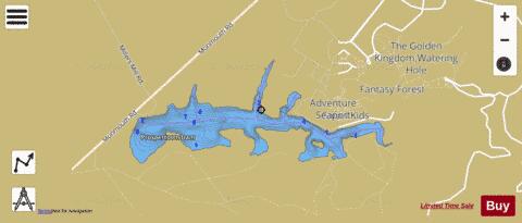
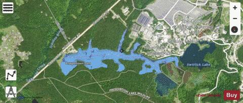
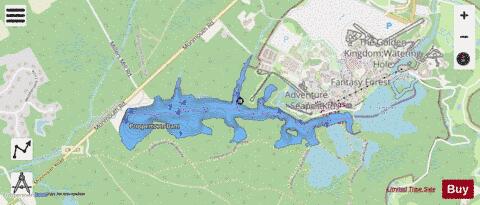
Prospertown Lake Fishing Map Stats | |
| Title | Prospertown Lake |
| Scale | 1:6000 |
| Counties | Ocean |
| Nearby Cities | Francis Mills, Clarksburg, Cassville, Hornerstown, Cream Ridge, Imlaystown, Shrewsbury, Roosevelt, New Egypt, Pleasant Grove |
| Area * | 86.61 acres |
| Shoreline * | 4.80 miles |
| Min Longitude | -74.46 |
| Min Latitude | 40.13 |
| Max Longitude | -74.44 |
| Max Latitude | 40.14 |
| Edition Label 1 | |
| Edition Label 2 | |
| Edition Label 3 | |
| Id | US_AA_NJ_prospertown_lake_nj |
| Country | US |
| Projection | Mercator |
| * some Stats may include nearby/connecting waterbodies | |
|