Lout Pond fishing map is available as part of iBoating : USA Marine & Fishing App(now supported on multiple platforms including Android, iPhone/iPad, MacBook, and Windows(tablet and phone)/PC based chartplotter.).
With our Lake Maps App, you get all the great marine chart app features like fishing spots, along with Lout Pond depth map. The fishing maps app include HD lake depth contours, along with advanced features found in Fish Finder / Gps Chart Plotter systems, turning your device into a Depth Finder. The Lout Pond Navigation App provides advanced features of a Marine Chartplotter including adjusting water level offset and custom depth shading. Fishing spots and depth contours layers are available in most Lake maps. Lake navigation features include advanced instrumentation to gather wind speed direction, water temperature, water depth, and accurate GPS with AIS receivers(using NMEA over TCP/UDP). Autopilot support can be enabled during ‘Goto WayPoint’ and ‘Route Assistance’.
Now i-Boating supports Fishing Points in Lout Pond.
Have more questions about the Nautical Chart App? Ask us.
Fishing Info for Lout Pond
Lout Pond is an 18-acre (73,000 m2) kettlehole pond in Plymouth, Massachusetts, east of Billington Sea, southeast of Morton Park, and northwest of Cooks Pond. The pond has an average depth of 19 feet (5.8 m) and a maximum depth of 36 feet (11 m). The northern and southern shores have been developed extensively. Cranberry bogs are along the western shore, and Billington Street runs along the eastern shore. Parking is available along the side of the road; however, due to the steep bank only canoes and car top boats can be launched, electric motors only. "Lout" is a name derived from the Latin lout, meaning "clay" or "mud".
More on Wikipedia...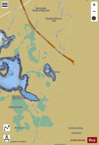

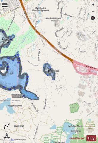
Lout Pond Fishing Map Stats | |
| Title | Lout Pond |
| Scale | 1:3000 |
| Counties | Plymouth |
| Nearby Cities | Plymouth, North Plymouth, Kingston, The Pinehills, South Duxbury, Carver, Duxbury, White Horse Beach, White Island Shores, Green Harbor |
| Area * | 17.81 acres |
| Shoreline * | 0.72 miles |
| Min Longitude | -70.67 |
| Min Latitude | 41.93 |
| Max Longitude | -70.67 |
| Max Latitude | 41.94 |
| Edition Label 1 | |
| Edition Label 2 | |
| Edition Label 3 | |
| Id | US_AA_MA_lout_pond_ma |
| Country | US |
| Projection | Mercator |
| * some Stats may include nearby/connecting waterbodies | |
|