Little Herring Pond fishing map is available as part of iBoating : USA Marine & Fishing App(now supported on multiple platforms including Android, iPhone/iPad, MacBook, and Windows(tablet and phone)/PC based chartplotter.).
With our Lake Maps App, you get all the great marine chart app features like fishing spots, along with Little Herring Pond depth map. The fishing maps app include HD lake depth contours, along with advanced features found in Fish Finder / Gps Chart Plotter systems, turning your device into a Depth Finder. The Little Herring Pond Navigation App provides advanced features of a Marine Chartplotter including adjusting water level offset and custom depth shading. Fishing spots and depth contours layers are available in most Lake maps. Lake navigation features include advanced instrumentation to gather wind speed direction, water temperature, water depth, and accurate GPS with AIS receivers(using NMEA over TCP/UDP). Autopilot support can be enabled during ‘Goto WayPoint’ and ‘Route Assistance’.
Have more questions about the Nautical Chart App? Ask us.
Fishing Info for Little Herring Pond
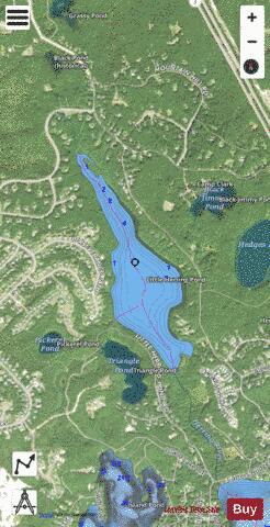
Little Herring Pond is a 90-acre (360,000 m2), shallow natural pond in the Cedarville section of Plymouth, Massachusetts, USA. The pond is located north of Great Herring Pond, west of Hedges Pond, southwest of Black Jimmy Pond (Hyles Pond), northeast of Island Pond and Triangle Pond, and east of Long Duck Pond. The pond has an average depth of three feet and a maximum depth of only four feet. The outflow is a stream that feeds Great Herring Pond, which in turn feeds the . Access to the pond is via a dirt road off Carters Bridge Road.
More on Wikipedia...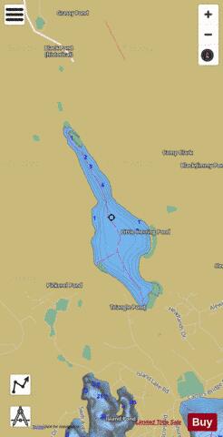

Little Herring Pond Fishing Map Stats | |
| Title | Little Herring Pond |
| Scale | 1:3000 |
| Counties | Plymouth |
| Nearby Cities | The Pinehills, White Island Shores, Sagamore, Bourne, Buzzards Bay, Sandwich, White Horse Beach, Monument Beach, Onset, Pocasset |
| Area * | 81.24 acres |
| Shoreline * | 2.49 miles |
| Min Longitude | -70.58 |
| Min Latitude | 41.82 |
| Max Longitude | -70.57 |
| Max Latitude | 41.83 |
| Edition Label 1 | |
| Edition Label 2 | |
| Edition Label 3 | |
| Id | US_AA_MA_little_herring_pond_ma |
| Country | US |
| Projection | Mercator |
| * some Stats may include nearby/connecting waterbodies | |
|