Elderberry Forebay fishing map is available as part of iBoating : USA Marine & Fishing App(now supported on multiple platforms including Android, iPhone/iPad, MacBook, and Windows(tablet and phone)/PC based chartplotter.).
With our Lake Maps App, you get all the great marine chart app features like fishing spots, along with Elderberry Forebay lake depth map. The fishing maps app include HD lake depth contours, along with advanced features found in Fish Finder / Gps Chart Plotter systems, turning your device into a Depth Finder. The Elderberry Forebay Navigation App provides advanced features of a Marine Chartplotter including adjusting water level offset and custom depth shading. Fishing spots and depth contours layers are available in most Lake maps. Lake navigation features include advanced instrumentation to gather wind speed direction, water temperature, water depth, and accurate GPS with AIS receivers(using NMEA over TCP/UDP). Autopilot support can be enabled during ‘Goto WayPoint’ and ‘Route Assistance’.
Now i-Boating supports Fishing Points in Elderberry Forebay.
Have more questions about the Nautical Chart App? Ask us.
Fishing Info for Elderberry Forebay
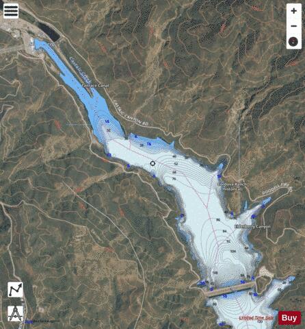
Elderberry Forebay is a small reservoir in Los Angeles County, California, which serves as the pumping forebay of the Castaic Power Plant. It located at the upper end of the larger Castaic Lake and is separated from the lake by Elderberry Forebay Dam at its southern edge. Entering the northern end of the forebay is the west branch of the California Aqueduct, which connects the forebay to Pyramid Lake through the Angeles Tunnel. A component of the California State Water Project, the reservoir was partitioned from Castaic Lake in 1974 to store water for pumped-storage hydroelectricity generation. During on-peak energy-demand hours, water flows 7.5 miles (12.1 km) from Pyramid Lake through the Angeles Tunnel and then on to the turbines of the Castaic Power Plant, producing electricity. From there, the water flows into Elderberry Forebay. During off-peak hours (including nighttime and Sundays), water is pumped from the forebay, back through the tunnel and into Pyramid Lake.
More on Wikipedia...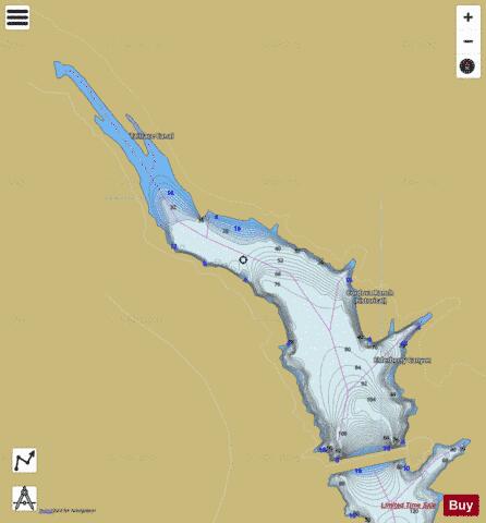
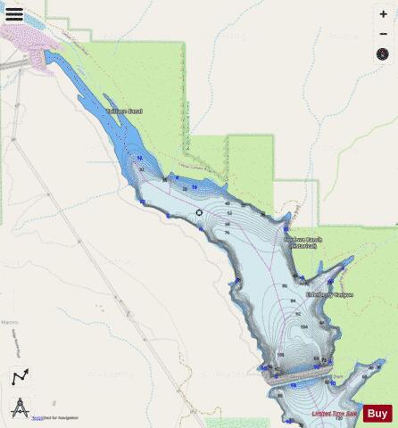
Elderberry Forebay Fishing Map Stats | |
| Title | Elderberry Forebay |
| Scale | 1:12000 |
| Counties | Los Angeles |
| Nearby Cities | Castaic, Val Verde, Saugus, Santa Clarita, Newhall, Lake Hughes, Piru, Green Valley, Gorman, Santa Susana |
| Area * | 382.10 acres |
| Shoreline * | 7.07 miles |
| Min Longitude | -118.66 |
| Min Latitude | 34.56 |
| Max Longitude | -118.63 |
| Max Latitude | 34.59 |
| Edition Label 1 | |
| Edition Label 2 | |
| Edition Label 3 | |
| Id | US_AA_CA_elderberryforebay_ca |
| Country | US |
| Projection | Mercator |
| * some Stats may include nearby/connecting waterbodies | |
|