New Hogan Lake fishing map is available as part of iBoating : USA Marine & Fishing App(now supported on multiple platforms including Android, iPhone/iPad, MacBook, and Windows(tablet and phone)/PC based chartplotter.).
With our Lake Maps App, you get all the great marine chart app features like fishing spots, along with New Hogan Lake depth map. The fishing maps app include HD lake depth contours, along with advanced features found in Fish Finder / Gps Chart Plotter systems, turning your device into a Depth Finder. The New Hogan Lake Navigation App provides advanced features of a Marine Chartplotter including adjusting water level offset and custom depth shading. Fishing spots and depth contours layers are available in most Lake maps. Lake navigation features include advanced instrumentation to gather wind speed direction, water temperature, water depth, and accurate GPS with AIS receivers(using NMEA over TCP/UDP). Autopilot support can be enabled during ‘Goto WayPoint’ and ‘Route Assistance’.
Now i-Boating supports Fishing Points in New Hogan Lake.
Have more questions about the Nautical Chart App? Ask us.
Fishing Info for New Hogan Lake
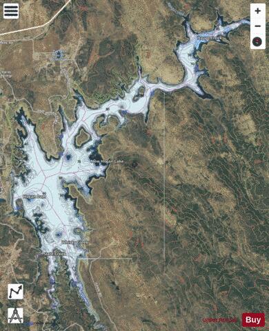
New Hogan Lake is an artificial lake in the foothills of the Sierra Nevada in Calaveras County, California, about 30 miles (48.3 km) northeast of Stockton. It is formed by New Hogan Dam on the Calaveras River, whose North and South forks combine just upstream of the lake, and has a capacity of 317,000 acre⋅ft (391,000,000 m3). The earth-fill dam, completed in 1963, is 210 feet (64.0 m) high from the crest of the dam to the original streambed. The reservoir was first filled in 1965. There is a small hydroelectric plant at its base. It is owned by the United States Army Corps of Engineers and provides flood protection, drinking water, electricity and water for irrigation. There is also recreation available, such as boating, fishing, water skiing and camping.
More on Wikipedia...Popular fish species in this lake include Crappie and Striped bass.
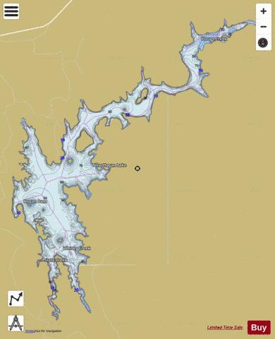
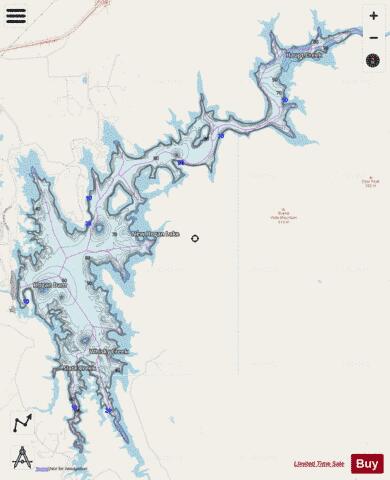
New Hogan Lake Fishing Map Stats | |
| Title | New Hogan Lake |
| Scale | 1:12000 |
| Counties | Calaveras |
| Nearby Cities | Valley Springs, San Andreas, Rancho Calaveras, Mokelumne Hill, Jackson, Buena Vista, Camanche North Shore, Wallace, Martell, Camanche Village |
| Area * | 2274.88 acres |
| Shoreline * | 39.50 miles |
| Min Longitude | -120.81 |
| Min Latitude | 38.12 |
| Max Longitude | -120.73 |
| Max Latitude | 38.20 |
| Edition Label 1 | |
| Edition Label 2 | |
| Edition Label 3 | |
| Id | US_AA_CA_00254970 |
| Country | US |
| Projection | Mercator |
| * some Stats may include nearby/connecting waterbodies | |
|