Lake McClure fishing map is available as part of iBoating : USA Marine & Fishing App(now supported on multiple platforms including Android, iPhone/iPad, MacBook, and Windows(tablet and phone)/PC based chartplotter.).
With our Lake Maps App, you get all the great marine chart app features like fishing spots, along with Lake McClure depth map. The fishing maps app include HD lake depth contours, along with advanced features found in Fish Finder / Gps Chart Plotter systems, turning your device into a Depth Finder. The Lake McClure Navigation App provides advanced features of a Marine Chartplotter including adjusting water level offset and custom depth shading. Fishing spots and depth contours layers are available in most Lake maps. Lake navigation features include advanced instrumentation to gather wind speed direction, water temperature, water depth, and accurate GPS with AIS receivers(using NMEA over TCP/UDP). Autopilot support can be enabled during ‘Goto WayPoint’ and ‘Route Assistance’.
Now i-Boating supports Fishing Points in Lake McClure.
Have more questions about the Nautical Chart App? Ask us.
Fishing Info for Lake McClure
Lake McClure is a reservoir in the Sierra Nevada foothills of western Mariposa County, California. It is formed by the New Exchequer Dam impounding the Merced River, which is a tributary of the San Joaquin River. It is about 40 miles (64 km) east of Modesto. The California Office of Environmental Health Hazard Assessment (OEHHA) has developed a safe eating advisory for Lake McClure based on levels of mercury found in fish caught from this water body
More on Wikipedia...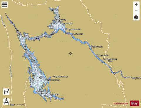
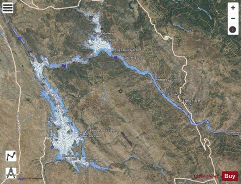
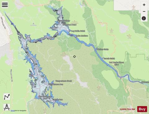
Lake McClure Fishing Map Stats | |
| Title | Lake McClure |
| Scale | 1:24000 |
| Counties | Mariposa |
| Nearby Cities | Coulterville, Bear Valley, Hornitos, Greeley Hill, Moccasin, Big Oak Flat, Groveland, Pine Mountain Lake, Catheys Valley, Snelling |
| Area * | 5691.16 acres |
| Shoreline * | 93.77 miles |
| Min Longitude | -120.32 |
| Min Latitude | 37.57 |
| Max Longitude | -120.10 |
| Max Latitude | 37.70 |
| Edition Label 1 | |
| Edition Label 2 | |
| Edition Label 3 | |
| Id | US_AA_CA_00245652 |
| Country | US |
| Projection | Mercator |
| * some Stats may include nearby/connecting waterbodies | |
|