Gjevilvatnet fishing map is included in ֳ˜stfold nautical charts folio. It is available as part of iBoating : Norway Marine & Fishing App (now supported on multiple platforms including Android, iPhone/iPad, MacBook, and Windows(tablet and phone)/PC based chartplotter. ).
With our Lake Maps App, you get all the great marine chart app features like fishing spots, along with Gjevilvatnet lake depth map. The fishing maps app include HD lake depth contours, along with advanced features found in Fish Finder / Gps Chart Plotter systems, turning your device into a Depth Finder. The Gjevilvatnet Navigation App provides advanced features of a Marine Chartplotter including adjusting water level offset and custom depth shading. Fishing spots and depth contours layers are available in most Lake maps. Lake navigation features include advanced instrumentation to gather wind speed direction, water temperature, water depth, and accurate GPS with AIS receivers(using NMEA over TCP/UDP). Autopilot support can be enabled during ג€˜Goto WayPointג€™ and ג€˜Route Assistanceג€™.
Have more questions about the Nautical Chart App? Ask us.
Fishing Info for Gjevilvatnet
Gjevillvatnet (or Gjevilvatnet) is a lake in the municipality of Oppdal in Trֳ¸ndelag county, Norway. It is located in the Trollheimen mountain range, about 5 kilometres (3.1 mi) south of the mountain Blֳ¥hֳ¸a and about 5 kilometres (3.1 mi) northwest of the village of Vognillan. The lake was regulated for hydroelectric power-production in the 1970s. Water is tapped from the bottom in the western part of the lake, for use in the Driva power station. In the spring, the water level can be 15 metres (49 ft) below the natural water level. The river Festa runs out of the lake Gjevillvatnet, and it was once a very good trout river from where the lake is now, all the way down to the intake dam at the old powerstation (Vardammen). This river now mostly runs dry every year due to the dam on Gjevillvatnet, and the trout are almost non-existent in the watercourse. The Gjevilvass valley is still regarded as one of Norway's most scenic valleys, and a cruise boat runs on the lake during summer. Along the middle of the lake, lies the Gjevillvasshytta, a lodge owned by Trondheim Turistforening. Here guests can eat, sleep, and use the lodge as a starting point for walking trips in the Trollheimen mountains.
More on Wikipedia...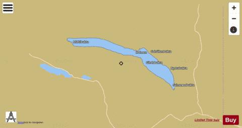
Gjevilvatnet Fishing Map Stats | |
| Title | Gjevilvatnet |
| Scale | 1:24000 |
| Min Longitude | 9.20 |
| Min Latitude | 62.65 |
| Max Longitude | 9.49 |
| Max Latitude | 62.71 |
| Edition Label 1 | |
| Edition Label 2 | |
| Edition Label 3 | |
| Id | NO_LK_2101 |
| Country | Norway |
| Projection | Mercator |
| * some Stats may include nearby/connecting waterbodies | |
|