Randsfjorden fishing map is included in ֳ˜stfold nautical charts folio. It is available as part of iBoating : Norway Marine & Fishing App (now supported on multiple platforms including Android, iPhone/iPad, MacBook, and Windows(tablet and phone)/PC based chartplotter. ).
With our Lake Maps App, you get all the great marine chart app features like fishing spots, along with Randsfjorden lake depth map. The fishing maps app include HD lake depth contours, along with advanced features found in Fish Finder / Gps Chart Plotter systems, turning your device into a Depth Finder. The Randsfjorden Navigation App provides advanced features of a Marine Chartplotter including adjusting water level offset and custom depth shading. Fishing spots and depth contours layers are available in most Lake maps. Lake navigation features include advanced instrumentation to gather wind speed direction, water temperature, water depth, and accurate GPS with AIS receivers(using NMEA over TCP/UDP). Autopilot support can be enabled during ג€˜Goto WayPointג€™ and ג€˜Route Assistanceג€™.
Have more questions about the Nautical Chart App? Ask us.
Fishing Info for Randsfjorden
Randsfjorden is Norway's fourth-largest lake with an area of 139.23 km2 (53.76 sq mi). Its volume is estimated at just over 7 km3 (1.7 cu mi), and its greatest depth is 120 m (390 ft). The lake is 135 m (443 ft) above sea level. It is located in the county of Innlandet and borders the municipalities of Gran, Jevnaker, Nordre Land, and Sֳ¸ndre Land in the districts of Land and Hadeland. It is drained by the river. Although the term fjord usually describes a saltwater inlet, Randsfjorden is actually a freshwater lake with a narrow shape, approximately aligned on a northג€“south axis. In Heimskringla, Snorri Sturluson recorded that Halfdan the Black (Halvdan Svarte), father of Harald Hֳ¥rfagre, the first King of Norway, journeyed over the lake while returning home from a visit to Hadeland. Traveling with a horse and sleigh while the lake was supposedly frozen, he fell through the ice and drowned. In modern times, many golf courses have been set up on the edge of the lake.There is a car ferry connection between Horn on the east bank and Tangen on the west, which is Norway's last remaining and regularly operating car ferry connection on an inland lake. Sightseeing boat MS Kong Haud sails on Randsfjorden from Jevnaker to Odnes.
More on Wikipedia...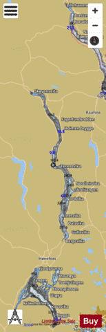
Randsfjorden Fishing Map Stats | |
| Title | Randsfjorden |
| Scale | 1:24000 |
| Min Longitude | 10.12 |
| Min Latitude | 60.23 |
| Max Longitude | 10.48 |
| Max Latitude | 60.81 |
| Edition Label 1 | |
| Edition Label 2 | |
| Edition Label 3 | |
| Id | NO_LK_523 |
| Country | Norway |
| Projection | Mercator |
| * some Stats may include nearby/connecting waterbodies | |
| ||||||||||||||||||||||||||||||||||||||||||||||||||||||||||||||||||||||||||||||||||||||||||||||||||||||||
|