Sperillen fishing map is included in ֳ˜stfold nautical charts folio. It is available as part of iBoating : Norway Marine & Fishing App (now supported on multiple platforms including Android, iPhone/iPad, MacBook, and Windows(tablet and phone)/PC based chartplotter. ).
With our Lake Maps App, you get all the great marine chart app features like fishing spots, along with Sperillen lake depth map. The fishing maps app include HD lake depth contours, along with advanced features found in Fish Finder / Gps Chart Plotter systems, turning your device into a Depth Finder. The Sperillen Navigation App provides advanced features of a Marine Chartplotter including adjusting water level offset and custom depth shading. Fishing spots and depth contours layers are available in most Lake maps. Lake navigation features include advanced instrumentation to gather wind speed direction, water temperature, water depth, and accurate GPS with AIS receivers(using NMEA over TCP/UDP). Autopilot support can be enabled during ג€˜Goto WayPointג€™ and ג€˜Route Assistanceג€™.
Have more questions about the Nautical Chart App? Ask us.
Fishing Info for Sperillen
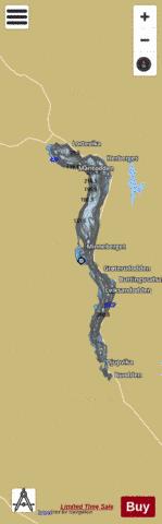
Sperillen is a lake in the valley of ֳ…dal in Ringerike municipality, Viken county, Norway. The lake has an area of 37 kmֲ² and extending about 26 km in length. It is 108 meters deep at its deepest and lies at 150 meters above sea level. Two rivers from Oppland, Begna from the valley of Begnadalen and Urula from the valley of Hedalen, flow into the lake at the northern end on either side of the town of Nes in ֳ…dal. At the southern end, ֳ…dal river flows downstream from Sperillen. The outflow powers a hydro-electric power station at Ringmoen. European route E16 follows the east side of the lake. The name Sperillen is derived from the Old Norse Sperֳ°ill which means "tail" and may refer to the elongated form of the lake. The lake is well known for its fisheries and is one of only a few in Norway with a commercial fishery. Common species are whitefish, char, European perch and trout, as well as crayfish. From 1868 to 1929, transport along the lake was principally supplied by a small steamship, DS Bֳ¦gna, which ran from the terminus of the Sperillen Line at Finsand on the southern end of the lake to Nes at the northern end. DS Bֳ¦gna went in service in 1868 and continued in traffic until 1929, when it was replaced with a motor ship, DS Spirillen.
More on Wikipedia...Popular fish species in this lake include Freshwater whitefish and Salvelinus.
Sperillen Fishing Map Stats | |
| Title | Sperillen |
| Scale | 1:24000 |
| Min Longitude | 9.98 |
| Min Latitude | 60.35 |
| Max Longitude | 10.10 |
| Max Latitude | 60.56 |
| Edition Label 1 | |
| Edition Label 2 | |
| Edition Label 3 | |
| Id | NO_LK_514 |
| Country | Norway |
| Projection | Mercator |
| * some Stats may include nearby/connecting waterbodies | |
|