BjГёrnsjГёen fishing map is included in Гҳstfold nautical charts folio. It is available as part of iBoating : Norway Marine & Fishing App (now supported on multiple platforms including Android, iPhone/iPad, MacBook, and Windows(tablet and phone)/PC based chartplotter. ).
With our Lake Maps App, you get all the great marine chart app features like fishing spots, along with BjГёrnsjГёen lake depth map. The fishing maps app include HD lake depth contours, along with advanced features found in Fish Finder / Gps Chart Plotter systems, turning your device into a Depth Finder. The BjГёrnsjГёen Navigation App provides advanced features of a Marine Chartplotter including adjusting water level offset and custom depth shading. Fishing spots and depth contours layers are available in most Lake maps. Lake navigation features include advanced instrumentation to gather wind speed direction, water temperature, water depth, and accurate GPS with AIS receivers(using NMEA over TCP/UDP). Autopilot support can be enabled during вҖҳGoto WayPointвҖҷ and вҖҳRoute AssistanceвҖҷ.
Have more questions about the Nautical Chart App? Ask us.
Fishing Info for BjГёrnsjГёen
BjГёrnsjГёen is a lake in Nordmarka in Oslo, Norway. The cabin Kikutstua, owned by the Association for the Promotion of Skiing, is located at the northeastern shore of the lake. AsbjГёrnsen's story "En Nat i Nordmarken" is set at BjГёrnsjГёen. BjГёrnsjГёen drains through the river BjГёrnsjГёelva to the lake SkjГҰrsjГёen.
More on Wikipedia...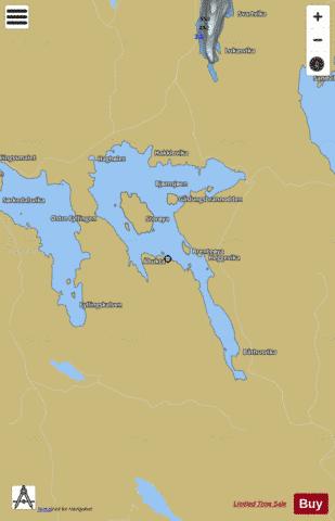
BjГёrnsjГёen Fishing Map Stats | |
| Title | BjГёrnsjГёen |
| Scale | 1:12000 |
| Min Longitude | 10.65 |
| Min Latitude | 60.05 |
| Max Longitude | 10.69 |
| Max Latitude | 60.08 |
| Edition Label 1 | |
| Edition Label 2 | |
| Edition Label 3 | |
| Id | NO_LK_302 |
| Country | Norway |
| Projection | Mercator |
| * some Stats may include nearby/connecting waterbodies | |
| |||||||||||||||||||||||||||||||||||||||||||||||||||||||||||||||||||||||||||||||||||||||||||||||||||||||
|