Mֳ¸svatn fishing map is included in ֳ˜stfold nautical charts folio. It is available as part of iBoating : Norway Marine & Fishing App (now supported on multiple platforms including Android, iPhone/iPad, MacBook, and Windows(tablet and phone)/PC based chartplotter. ).
With our Lake Maps App, you get all the great marine chart app features like fishing spots, along with Mֳ¸svatn lake depth map. The fishing maps app include HD lake depth contours, along with advanced features found in Fish Finder / Gps Chart Plotter systems, turning your device into a Depth Finder. The Mֳ¸svatn Navigation App provides advanced features of a Marine Chartplotter including adjusting water level offset and custom depth shading. Fishing spots and depth contours layers are available in most Lake maps. Lake navigation features include advanced instrumentation to gather wind speed direction, water temperature, water depth, and accurate GPS with AIS receivers(using NMEA over TCP/UDP). Autopilot support can be enabled during ג€˜Goto WayPointג€™ and ג€˜Route Assistanceג€™.
Have more questions about the Nautical Chart App? Ask us.
Fishing Info for Mֳ¸svatn
Mֳ¸svatn (or Mֳ¸svann) is the tenth-largest lake in Norway with a surface area of 78.31 km2. It lies primarily , Vinje in Vestfold og Telemark. The lake lies in the watershed of the Skien river (Skiensvassdrag) and discharges into the Mֳ¥na river. Along the shores of the lake, many traces of Stone Age settlers can be found. It is 919 meters above sea level and regulated to use for hydroelectric production. Some of Norway's highest mountain farms can be found here as well. On 19 November 1942, as part of the efforts to sabotage German heavy water production, gliderborne troops were to land on the frozen lake Mֳ¸svatn near the Vemork hydroelectric plant, run by Norsk Hydro, near Rjukan. This effort was not successful; however ultimately the Norwegians stopped the heavy water production activities and helped limit the German nuclear weapons research program. The museum and visitor's centre Hardangervidda Natursenter is located close to the lake. From Skinnarbu there is a boattrip with the MB Fjellvֳ¥ken to Mogen.
More on Wikipedia...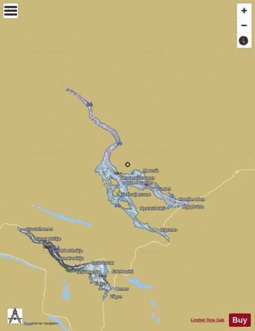
Mֳ¸svatn Fishing Map Stats | |
| Title | Mֳ¸svatn |
| Scale | 1:24000 |
| Min Longitude | 7.88 |
| Min Latitude | 59.75 |
| Max Longitude | 8.32 |
| Max Latitude | 60.02 |
| Edition Label 1 | |
| Edition Label 2 | |
| Edition Label 3 | |
| Id | NO_LK_3 |
| Country | Norway |
| Projection | Mercator |
| * some Stats may include nearby/connecting waterbodies | |
|