Jølstravatnet fishing map is included in Østfold nautical charts folio. It is available as part of iBoating : Norway Marine & Fishing App (now supported on multiple platforms including Android, iPhone/iPad, MacBook, and Windows(tablet and phone)/PC based chartplotter. ).
With our Lake Maps App, you get all the great marine chart app features like fishing spots, along with Jølstravatnet lake depth map. The fishing maps app include HD lake depth contours, along with advanced features found in Fish Finder / Gps Chart Plotter systems, turning your device into a Depth Finder. The Jølstravatnet Navigation App provides advanced features of a Marine Chartplotter including adjusting water level offset and custom depth shading. Fishing spots and depth contours layers are available in most Lake maps. Lake navigation features include advanced instrumentation to gather wind speed direction, water temperature, water depth, and accurate GPS with AIS receivers(using NMEA over TCP/UDP). Autopilot support can be enabled during ‘Goto WayPoint’ and ‘Route Assistance’.
Have more questions about the Nautical Chart App? Ask us.
Fishing Info for Jølstravatnet
The Jølstra is a river in Sunnfjord Municipality in Vestland county, Norway. The 22-kilometre (14 mi) long river flows from the lake of Jølstravatnet (at an elevation of 207 metres (679 ft) above sea level) down to the Førdefjorden (which is at sea level). The river begins at the village of Vassenden, on the shores of the lake, it then goes past the village of Langhaugane, then past the Moskog area of Førde, past the village of Bruland, and it finally flows to its mouth at the town of Førde, on the shores of the fjord. There are four hydroelectric power stations in the river. The average rate of flow in Jølstra is given as 43.9 cubic metres per second (1,550 cu ft/s), measured at Høgset over the period from 1993 to 2011. The highest recorded flow rate during this period was 256 cubic metres per second (9,000 cu ft/s), while the lowest recorded flow rate was 1.2 cubic metres per second (42 cu ft/s).
More on Wikipedia...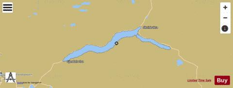
Jølstravatnet Fishing Map Stats | |
| Title | Jølstravatnet |
| Scale | 1:24000 |
| Min Longitude | 6.11 |
| Min Latitude | 61.49 |
| Max Longitude | 6.62 |
| Max Latitude | 61.57 |
| Edition Label 1 | |
| Edition Label 2 | |
| Edition Label 3 | |
| Id | NO_LK_1734 |
| Country | Norway |
| Projection | Mercator |
| * some Stats may include nearby/connecting waterbodies | |
|