Valkjärvi marine chart is included in Finland Lakes nautical charts folio. It is available as part of iBoating : Finland Marine & Fishing App (now supported on multiple platforms including Android, iPhone/iPad, MacBook, and Windows(tablet and phone)/PC based chartplotter. ).
When you purchase our Nautical Charts App, you get all the great marine chart app features like fishing spots, along with Valkjärvi marine chart. The Marine Navigation App provides advanced features of a Marine Chartplotter including adjusting water level offset and custom depth shading. Fishing spots and depth contours layers are available in most Lake maps. Nautical navigation features include advanced instrumentation to gather wind speed direction, water temperature, water depth, and accurate GPS with AIS receivers(using NMEA over TCP/UDP). Autopilot support can be enabled during ‘Goto WayPoint’ and ‘Route Assistance’. Now Automatic Slip to Slip Boat routing based Boat's Draft (draught) is available for water mapped by this chart.
Have more questions about the Nautical Chart App? Ask us.
Fishing Info for Valkjärvi
Valkjärvi is a lake located in the Nurmijärvi municipality in Southern Finland. It is an island-free lake in the immediate vicinity of Klaukkala's urban area. The water flows from the lake along the Luhtajoki River all the way to the Vantaa River. Valkjärvi is the most lushest lake of Nurmijärvi, and it is part of the Nurmijärvi's lake monitoring program of the Central Uusimaa Environment Centre (Keski-Uudenmaan ympäristökeskus) due to its poor oxygen values near the bottom of the lake, which are observed especially in summer and winter under ice. Blue-green algae are quite common in the lake; in July 2015, the phytoplankton in the lake with the highest total biomass consisted of 40% cyanobacteria and 29% cryptomonad. Despite all this, Valkjärvi has great recreational value and there are quite a lot of both permanent and holiday settlements around the lake. There are two beaches at the southern end of Valkjärvi: Tiiranranta Beach and Lähtelä Beach.
More on Wikipedia...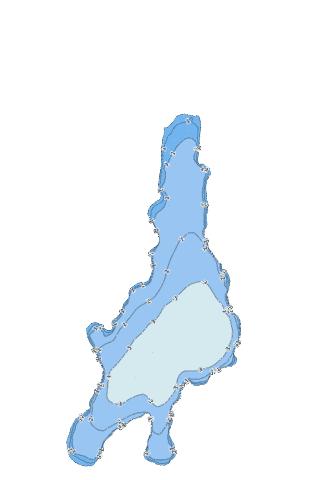
Valkjärvi Stats | |
| Title | Valkjärvi |
| Scale | 1:12000 |
| Min Longitude | 24.71 |
| Min Latitude | 60.39 |
| Max Longitude | 24.73 |
| Max Latitude | 60.42 |
| Edition Label 1 | |
| Edition Label 2 | |
| Edition Label 3 | |
| Id | FI_21_054_1_001 |
| Country | Finland |
| Projection | Mercator |
| * some Stats may include nearby/connecting waterbodies | |
|