Kuolimo marine chart is included in Finland Lakes nautical charts folio. It is available as part of iBoating : Finland Marine & Fishing App (now supported on multiple platforms including Android, iPhone/iPad, MacBook, and Windows(tablet and phone)/PC based chartplotter. ).
When you purchase our Nautical Charts App, you get all the great marine chart app features like fishing spots, along with Kuolimo marine chart. The Marine Navigation App provides advanced features of a Marine Chartplotter including adjusting water level offset and custom depth shading. Fishing spots and depth contours layers are available in most Lake maps. Nautical navigation features include advanced instrumentation to gather wind speed direction, water temperature, water depth, and accurate GPS with AIS receivers(using NMEA over TCP/UDP). Autopilot support can be enabled during ‘Goto WayPoint’ and ‘Route Assistance’. Now Automatic Slip to Slip Boat routing based Boat's Draft (draught) is available for water mapped by this chart.
Have more questions about the Nautical Chart App? Ask us.
Fishing Info for Kuolimo
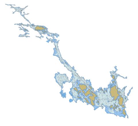
Kuolimo is a medium-sized lake in south-eastern Finland, in the municipalities of Savitaipale and Suomenniemi. Lake Kuolimo is closely linked to Finland's largest lake Saimaa, and discharges into it through two separate routes, featuring the rapids of Partakoski and Kärnänkoski. The lakes belong to the Vuoksi river basin, which drains through Lake Ladoga to the Gulf of Finland. Kuolimo is considered a particularly clean-water lake. It is inhabited by a relict population of the Arctic char. The critically endangered fish lives only certain parts of southern Lake Saimaa, including Yövesi, and . The original population lives only in Lake Kuolimo. Fishing of the Arctic char is totally prohibited.
More on Wikipedia...Popular fish species in this lake include Arctic char.
Kuolimo Stats | |
| Title | Kuolimo |
| Scale | 1:24000 |
| Min Longitude | 27.22 |
| Min Latitude | 61.20 |
| Max Longitude | 27.71 |
| Max Latitude | 61.41 |
| Edition Label 1 | |
| Edition Label 2 | |
| Edition Label 3 | |
| Id | FI_04_141_1_001 |
| Country | Finland |
| Projection | Mercator |
| * some Stats may include nearby/connecting waterbodies | |
|