Cowan Lake fishing map is included in Saskatchewan Fishing Maps nautical charts folio. It is available as part of iBoating : Canada Marine & Fishing App (now supported on multiple platforms including Android, iPhone/iPad, MacBook, and Windows(tablet and phone)/PC based chartplotter. ).
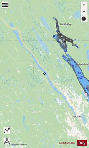
With our Lake Maps App, you get all the great marine chart app features like fishing spots, along with Cowan Lake depth map. The fishing maps app include HD lake depth contours, along with advanced features found in Fish Finder / Gps Chart Plotter systems, turning your device into a Depth Finder. The Cowan Lake Navigation App provides advanced features of a Marine Chartplotter including adjusting water level offset and custom depth shading. Fishing spots and depth contours layers are available in most Lake maps. Lake navigation features include advanced instrumentation to gather wind speed direction, water temperature, water depth, and accurate GPS with AIS receivers(using NMEA over TCP/UDP). Autopilot support can be enabled during ‘Goto WayPoint’ and ‘Route Assistance’.
Now i-Boating supports Fishing Points in Cowan Lake.
Have more questions about the Nautical Chart App? Ask us.
Fishing Info for Cowan Lake
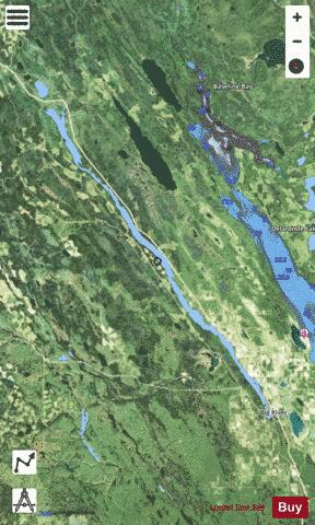
Cowan River is a river in the west-central part of the Canadian province of Saskatchewan in the boreal forest ecozone of Canada. The river begins at Cowan Lake Dam near the northern end of Cowan Lake and flows north-west through muskeg and forest to meet Beaver River. Beaver River then flows into Lac Île-à-la-Crosse and the Churchill River. The entirety of Cowen River is within the Northern Saskatchewan Administration District and while there are no communities along its course, the towns of Big River and Spiritwood are in its watershed. Within Cowan River's watershed, there are many lakes and rivers. Some of the more notable include the river's source, Cowan Lake and its primary inflow, Big River, , Taggart Lake, Little Whitefish Lake, Witchekan Lake, and Ladder Lake. Delaronde Lake is at the western edge of the Waskesiu Upland and several creeks and rivers flow from the upland into the lake. Delaronde Lake then flows into Taggart Lake which connects to Cowan River through Taggart Creek. At either end of the river, there's a provincial recreation site. Cowan Dam Recreation Site is at Cowan Lake Dam and Beaver / Cowan Rivers Recreation Site is at the confluence of Cowan River and Beaver River.
More on Wikipedia...Popular fish species in this lake include Northern pike and Walleye.
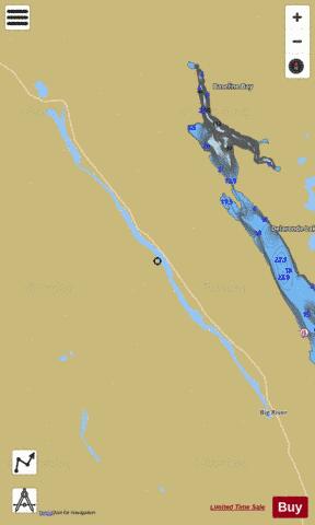
Cowan Lake Fishing Map Stats | |
| Title | Cowan Lake |
| Scale | 1:24000 |
| Nearby Cities | Shellbrook, Meadow Lake |
| Area * | 7871.63 acres |
| Shoreline * | 78.78 miles |
| Min Longitude | -107.49 |
| Min Latitude | 53.83 |
| Max Longitude | -107.04 |
| Max Latitude | 54.19 |
| Edition Label 1 | |
| Edition Label 2 | |
| Edition Label 3 | |
| Id | CA_SK_cowan_lake__sk |
| Country | CA |
| Projection | Mercator |
| * some Stats may include nearby/connecting waterbodies | |
|