Besnard Lake fishing map is included in Saskatchewan Fishing Maps nautical charts folio. It is available as part of iBoating : Canada Marine & Fishing App (now supported on multiple platforms including Android, iPhone/iPad, MacBook, and Windows(tablet and phone)/PC based chartplotter. ).
With our Lake Maps App, you get all the great marine chart app features like fishing spots, along with Besnard Lake depth map. The fishing maps app include HD lake depth contours, along with advanced features found in Fish Finder / Gps Chart Plotter systems, turning your device into a Depth Finder. The Besnard Lake Navigation App provides advanced features of a Marine Chartplotter including adjusting water level offset and custom depth shading. Fishing spots and depth contours layers are available in most Lake maps. Lake navigation features include advanced instrumentation to gather wind speed direction, water temperature, water depth, and accurate GPS with AIS receivers(using NMEA over TCP/UDP). Autopilot support can be enabled during ‘Goto WayPoint’ and ‘Route Assistance’.
Now i-Boating supports Fishing Points in Besnard Lake.
Have more questions about the Nautical Chart App? Ask us.
Fishing Info for Besnard Lake
Besnard Lake (/ˈbɛznɜːrd/ BEZ-nerd) is a lake in the Canadian province of Saskatchewan, 370 kilometres (230 mi) north of Saskatoon and 50 km (31 mi) west of La Ronge. It supports a large population of bald eagles that have been the subject of ongoing studies since the 1960s. The lake is 43 km (27 mi) from tip to tip with 400 km (250 mi) of shoreline. It has a surface area of 12,500 hectares (31,000 acres) and a maximum depth of 25 metres (82 ft), at an elevation of about 390 m (1,280 ft). At a narrows it is crossed by a bridge carrying provincial highway 910. This road was completed in 1973 and increased access to recreational fishing. There are over 250 islands on the lake, and the lakebed is rocky, making navigation difficult but creating a good habitat for fish. There are cabins, campgrounds and fishing camps on the lake. There is a 950 m (3,120 ft) airstrip 1 km (0.62 mi) south of the lake. Besnard Lake is within the Churchill River drainage system. While much of the lake is in the Canadian Shield, its southern portion is in the boreal forest where the Mercer River brings nutrients which leads to healthy invertebrate populations that provide plenty of food for the fish which are the mainstay of the eagles' diet. They fish mainly for white sucker and cisco, and occasionally pike, walleye and burbot. Compared to the nearby and similarly sized which is entirely on the shield, the eagle population has a higher density and stability.
More on Wikipedia...Popular fish species in this lake include Burbot, Northern pike, Walleye and White sucker.
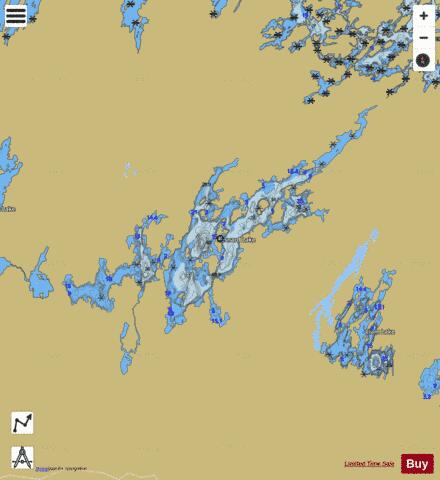
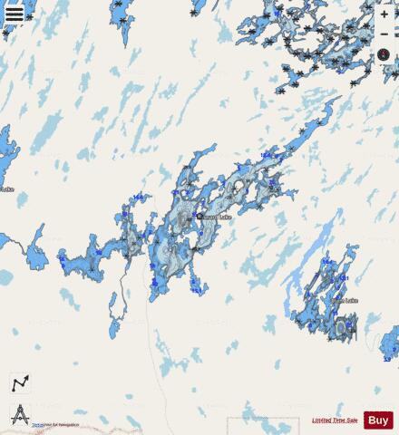
Besnard Lake Fishing Map Stats | |
| Title | Besnard Lake |
| Scale | 1:24000 |
| Nearby Cities | La Ronge |
| Area * | 43559.19 acres |
| Shoreline * | 383.96 miles |
| Min Longitude | -106.29 |
| Min Latitude | 55.27 |
| Max Longitude | -105.68 |
| Max Latitude | 55.56 |
| Edition Label 1 | |
| Edition Label 2 | |
| Edition Label 3 | |
| Id | CA_SK_besnard_lake_sk |
| Country | CA |
| Projection | Mercator |
| * some Stats may include nearby/connecting waterbodies | |
|