Nicolet, Lac fishing map is included in Quebec to Anticosti Island West nautical charts folio. It is available as part of iBoating : Canada Marine & Fishing App (now supported on multiple platforms including Android, iPhone/iPad, MacBook, and Windows(tablet and phone)/PC based chartplotter. ).
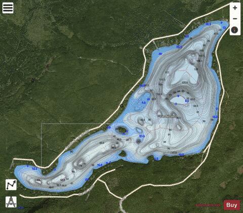
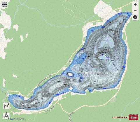
With our Lake Maps App, you get all the great marine chart app features like fishing spots, along with Nicolet, Lac depth map. The fishing maps app include HD lake depth contours, along with advanced features found in Fish Finder / Gps Chart Plotter systems, turning your device into a Depth Finder. The Nicolet, Lac Navigation App provides advanced features of a Marine Chartplotter including adjusting water level offset and custom depth shading. Fishing spots and depth contours layers are available in most Lake maps. Lake navigation features include advanced instrumentation to gather wind speed direction, water temperature, water depth, and accurate GPS with AIS receivers(using NMEA over TCP/UDP). Autopilot support can be enabled during ‘Goto WayPoint’ and ‘Route Assistance’.
Now i-Boating supports Fishing Points in Nicolet, Lac.
Have more questions about the Nautical Chart App? Ask us.
Fishing Info for Nicolet, Lac
Lake Nicolet (in French: lac Nicolet) is located 50 km south of Victoriaville, in the municipality of Saints-Martyrs-Canadiens, in Arthabaska Regional County Municipality (MRC), in administrative region of Centre-du-Québec, Canada. Lake Nicolet is the source of the Nicolet River which flows 137 kilometres (85 mi) to the southeast shore of lake Saint-Pierre, in Nicolet. The latest is crossed through the North-East by the St. Lawrence River. This lake is surrounded by Chemin du Lac-Nicolet (north-west side) and Chemin Gosford-Sud (south-east side).
More on Wikipedia...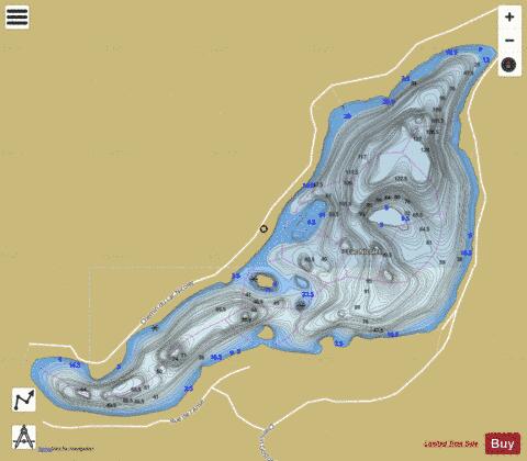
Nicolet, Lac Fishing Map Stats | |
| Title | Nicolet, Lac |
| Scale | 1:12000 |
| Districts | Arthabaska, Les Sources |
| Nearby Cities | Disraeli, Black Lake, Asbestos, East Angus, Thetford Mines, Cookshire, Warwick, Victoriaville, Danville, Plessisville |
| Area * | 1015.09 acres |
| Shoreline * | 9.18 miles |
| Min Longitude | -71.59 |
| Min Latitude | 45.82 |
| Max Longitude | -71.54 |
| Max Latitude | 45.85 |
| Edition Label 1 | |
| Edition Label 2 | |
| Edition Label 3 | |
| Id | CA_QC_V_01822 |
| Country | CA |
| Projection | Mercator |
| * some Stats may include nearby/connecting waterbodies | |
| |||||||||||||||||||||||||||||||||||||||||||||||||||||||||||||||||||||||||||||||||||||||||||||||||||||||
|