Agnew Lake fishing map is included in Ontario Lakes nautical charts folio. It is available as part of iBoating : Canada Marine & Fishing App (now supported on multiple platforms including Android, iPhone/iPad, MacBook, and Windows(tablet and phone)/PC based chartplotter. ).
With our Lake Maps App, you get all the great marine chart app features like fishing spots, along with Agnew Lake depth map. The fishing maps app include HD lake depth contours, along with advanced features found in Fish Finder / Gps Chart Plotter systems, turning your device into a Depth Finder. The Agnew Lake Navigation App provides advanced features of a Marine Chartplotter including adjusting water level offset and custom depth shading. Fishing spots and depth contours layers are available in most Lake maps. Lake navigation features include advanced instrumentation to gather wind speed direction, water temperature, water depth, and accurate GPS with AIS receivers(using NMEA over TCP/UDP). Autopilot support can be enabled during ‘Goto WayPoint’ and ‘Route Assistance’.
Now i-Boating supports Fishing Points in Agnew Lake.
Have more questions about the Nautical Chart App? Ask us.
Fishing Info for Agnew Lake
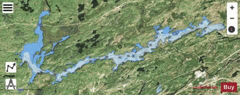
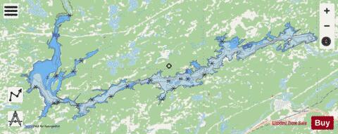
Agnew Lake is a lake on the Spanish River in the Sudbury District, Ontario, Canada. Its area is 2,940 hectares (7,300 acres) and its shoreline is 210 kilometres (130 mi) long. The lake is located primarily in the municipalities of Sables-Spanish Rivers, Baldwin and Nairn and Hyman, although its easternmost end enters the city limits of Greater Sudbury near High Falls. It is formed by the 353.57 metres (1,160.0 ft) long and 44.50 metres (146.0 ft) high Big Eddy Dam, built in 1920, and serves as the reservoir for several hydroelectric power stations downstream. The lake has been the site of varied mining activity, including drilling for diamonds in the earlier half of the 20th century and for uranium from 1977 to 1983 at Agnew Lake Mine. The lake was named after John Lyons Agnew, who became president and general manager of INCO in 1921.
More on Wikipedia...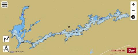
Agnew Lake Fishing Map Stats | |
| Title | Agnew Lake |
| Scale | 1:24000 |
| Districts | Greater Sudbury / Grand Sudbury, Sudbury |
| Nearby Cities | Espanola, Dowling, Little Current, Chelmsford, Lively, Azilda, Wikwemikong, Sudbury, Valley East, Coniston |
| Area * | 7816.43 acres |
| Shoreline * | 134.53 miles |
| Min Longitude | -81.90 |
| Min Latitude | 46.33 |
| Max Longitude | -81.57 |
| Max Latitude | 46.41 |
| Edition Label 1 | |
| Edition Label 2 | |
| Edition Label 3 | |
| Id | CA_ON_V_108034047 |
| Country | CA |
| Projection | Mercator |
| * some Stats may include nearby/connecting waterbodies | |
|