Shuswap Lake fishing map is included in Lakes and Rivers of British Columbia nautical charts folio. It is available as part of iBoating : Canada Marine & Fishing App (now supported on multiple platforms including Android, iPhone/iPad, MacBook, and Windows(tablet and phone)/PC based chartplotter. ).
With our Lake Maps App, you get all the great marine chart app features like fishing spots, along with Shuswap Lake depth map. The fishing maps app include HD lake depth contours, along with advanced features found in Fish Finder / Gps Chart Plotter systems, turning your device into a Depth Finder. The Shuswap Lake Navigation App provides advanced features of a Marine Chartplotter including adjusting water level offset and custom depth shading. Fishing spots and depth contours layers are available in most Lake maps. Lake navigation features include advanced instrumentation to gather wind speed direction, water temperature, water depth, and accurate GPS with AIS receivers(using NMEA over TCP/UDP). Autopilot support can be enabled during ‘Goto WayPoint’ and ‘Route Assistance’.
Now i-Boating supports Fishing Points in Shuswap Lake.
Have more questions about the Nautical Chart App? Ask us.
Fishing Info for Shuswap Lake
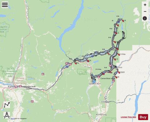
Little Shuswap Lake is a small lake in the Thompson River basin of the southern Interior of British Columbia, Canada, which sits at the transition between the Thompson Country to the west and the Shuswap Country to the east. It is fed by the Little River, which flows from Shuswap Lake, and is the main source of water for the South Thompson River, which begins at the lake's outlet at its southwestern end. The lake is approximately 7.8 kilometres (4.8 mi) in length, NE to SW, and averages 2.4 kilometres (1.5 mi) in width and is approximately 18 square kilometres (6.9 sq mi) in area. It has a mean depth of 14.3 metres (47 ft) to a maximum of 59.4 metres (195 ft). The recreational and Secwepemc First Nations community of Chase (known as Quaaout in the Secwepemc language) is at the lake's southern end. The smaller community of Squilax lies at the lake's northern end, on the north side of the estuary of the Little River. The TransCanada Highway and Canadian Pacific Railway run along the lake's eastern shore.
More on Wikipedia...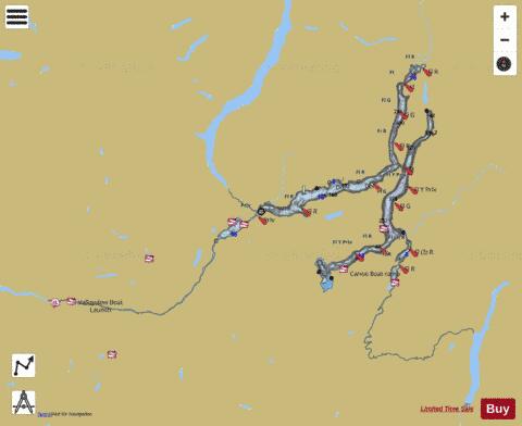
Shuswap Lake Fishing Map Stats | |
| Title | Shuswap Lake |
| Scale | 1:24000 |
| Districts | Columbia-Shuswap, North Okanagan, Thompson-Nicola |
| Nearby Cities | Sicamous, Canoe, Blind Bay, Enderby, Chase, Salmon Arm, Dallas, Kamloops, Rayleigh, Armstrong |
| Area * | 90035.58 acres |
| Shoreline * | 440.18 miles |
| Min Longitude | -120.34 |
| Min Latitude | 50.54 |
| Max Longitude | -118.74 |
| Max Latitude | 51.24 |
| Edition Label 1 | |
| Edition Label 2 | |
| Edition Label 3 | |
| Id | CA_BC_shuswap_mm_bc |
| Country | CA |
| Projection | Mercator |
| * some Stats may include nearby/connecting waterbodies | |
|