Mahoney (Maloney) Lake fishing map is included in Lakes and Rivers of British Columbia nautical charts folio. It is available as part of iBoating : Canada Marine & Fishing App (now supported on multiple platforms including Android, iPhone/iPad, MacBook, and Windows(tablet and phone)/PC based chartplotter. ).
With our Lake Maps App, you get all the great marine chart app features like fishing spots, along with Mahoney (Maloney) Lake depth map. The fishing maps app include HD lake depth contours, along with advanced features found in Fish Finder / Gps Chart Plotter systems, turning your device into a Depth Finder. The Mahoney (Maloney) Lake Navigation App provides advanced features of a Marine Chartplotter including adjusting water level offset and custom depth shading. Fishing spots and depth contours layers are available in most Lake maps. Lake navigation features include advanced instrumentation to gather wind speed direction, water temperature, water depth, and accurate GPS with AIS receivers(using NMEA over TCP/UDP). Autopilot support can be enabled during ‘Goto WayPoint’ and ‘Route Assistance’.
Now i-Boating supports Fishing Points in Mahoney (Maloney) Lake.
Have more questions about the Nautical Chart App? Ask us.
Fishing Info for Mahoney (Maloney) Lake
Mahoney Lake is a meromictic saline lake located near Okanagan Falls in British Columbia, Canada. It was established as an ecological reserve to preserve a southern interior saline lake, possessing unique limnological features in 1972. It has a unique layering, where the very bottom of the lake is very salt rich and contains hydrogen sulphide (H2S), which facilitates the growth of the purple sulphur bacteria in the layer above it, where the bacteria has just enough light to grow. The upper layer of the lake consists of a mixing layer of fresh water. Mahoney Lake is alkaline because it features no inflow or outflow of water. The lake also contains very low levels of oxygen and an approximate pH of 7.5-9.0. The surface area of the lake is 18ha and the surface area of the land is 21ha, with combined total of 21 ha.
More on Wikipedia...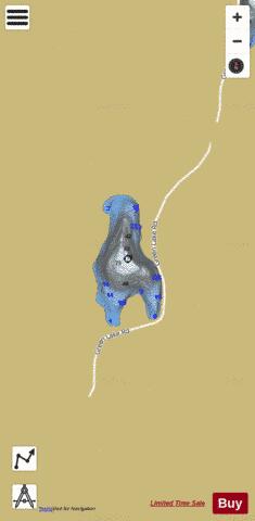
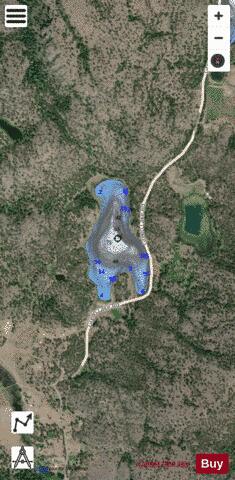
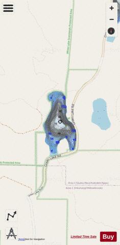
Mahoney (Maloney) Lake Fishing Map Stats | |
| Title | Mahoney (Maloney) Lake |
| Scale | 1:6000 |
| Districts | Okanagan-Similkameen |
| Nearby Cities | Okanagan Falls, Oliver, Penticton, Keremeos, Osoyoos, Naramata, Summerland, Peachland, Kelowna, Duck Lake |
| Area * | 44.62 acres |
| Shoreline * | 1.40 miles |
| Min Longitude | -119.58 |
| Min Latitude | 49.29 |
| Max Longitude | -119.58 |
| Max Latitude | 49.29 |
| Edition Label 1 | |
| Edition Label 2 | |
| Edition Label 3 | |
| Id | CA_BC_mahoney_lake__bc |
| Country | CA |
| Projection | Mercator |
| * some Stats may include nearby/connecting waterbodies | |
|