Lindeman Lake fishing map is included in Lakes and Rivers of British Columbia nautical charts folio. It is available as part of iBoating : Canada Marine & Fishing App (now supported on multiple platforms including Android, iPhone/iPad, MacBook, and Windows(tablet and phone)/PC based chartplotter. ).
With our Lake Maps App, you get all the great marine chart app features like fishing spots, along with Lindeman Lake depth map. The fishing maps app include HD lake depth contours, along with advanced features found in Fish Finder / Gps Chart Plotter systems, turning your device into a Depth Finder. The Lindeman Lake Navigation App provides advanced features of a Marine Chartplotter including adjusting water level offset and custom depth shading. Fishing spots and depth contours layers are available in most Lake maps. Lake navigation features include advanced instrumentation to gather wind speed direction, water temperature, water depth, and accurate GPS with AIS receivers(using NMEA over TCP/UDP). Autopilot support can be enabled during ‘Goto WayPoint’ and ‘Route Assistance’.
Now i-Boating supports Fishing Points in Lindeman Lake.
Have more questions about the Nautical Chart App? Ask us.
Fishing Info for Lindeman Lake
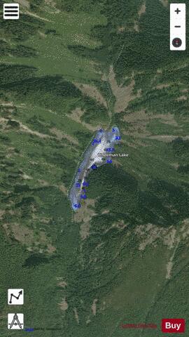
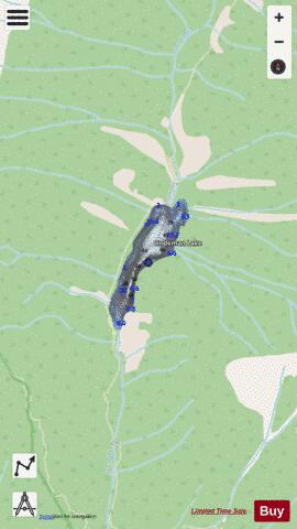
Lindeman Lake is a small lake in Chilliwack Lake Provincial Park, British Columbia, Canada. Located at the end of a 3.4 km trail, it is a popular hiking destination. A variety of fish inhabit this lake, including brook trout, cutthroat trout, rainbow trout, steelhead. Lindeman lake can be found by driving 40.5 km from Vedder Crossing along Chilliwack Lake road. Lindeman lake trail can be found on the left hand side of the road prior to Chilliwack Lake Provincial Park.
More on Wikipedia...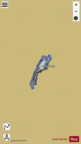
Lindeman Lake Fishing Map Stats | |
| Title | Lindeman Lake |
| Scale | 1:6000 |
| Districts | Fraser Valley |
| Nearby Cities | Hope, Rosedale, Kent, Harrison Hot Springs, Chilliwack, Cultus Lake, Mission, Abbotsford, Aldergrove East, Princeton |
| Area * | 28.08 acres |
| Shoreline * | 1.22 miles |
| Min Longitude | -121.46 |
| Min Latitude | 49.11 |
| Max Longitude | -121.45 |
| Max Latitude | 49.12 |
| Edition Label 1 | |
| Edition Label 2 | |
| Edition Label 3 | |
| Id | CA_BC_lindeman_lake__bc |
| Country | CA |
| Projection | Mercator |
| * some Stats may include nearby/connecting waterbodies | |
|