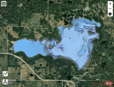
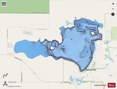
Miquelon Lakes fishing map is included in Alberta Lakes nautical charts folio. It is available as part of iBoating : Canada Marine & Fishing App (now supported on multiple platforms including Android, iPhone/iPad, MacBook, and Windows(tablet and phone)/PC based chartplotter. ).
With our Lake Maps App, you get all the great marine chart app features like fishing spots, along with Miquelon Lakes lake depth map. The fishing maps app include HD lake depth contours, along with advanced features found in Fish Finder / Gps Chart Plotter systems, turning your device into a Depth Finder. The Miquelon Lakes Navigation App provides advanced features of a Marine Chartplotter including adjusting water level offset and custom depth shading. Fishing spots and depth contours layers are available in most Lake maps. Lake navigation features include advanced instrumentation to gather wind speed direction, water temperature, water depth, and accurate GPS with AIS receivers(using NMEA over TCP/UDP). Autopilot support can be enabled during ‘Goto WayPoint’ and ‘Route Assistance’.
Now i-Boating supports Fishing Points in Miquelon Lakes.
Have more questions about the Nautical Chart App? Ask us.
Fishing Info for Miquelon Lakes
Miquelon Lake (/ˈmɪkəlɒn/) is a saline lake in Alberta, Canada, located in the heart of Miquelon Lake Provincial Park. The lake is no longer accessible for recreation as its water levels have dropped drastically since the 1920s. The lake is relatively shallow, only allowing for paddle boats such as canoes or kayaks. High salinity levels stunt the growth of algae and are responsible for the loss of fish life and the white residue found along the shoreline.
More on Wikipedia...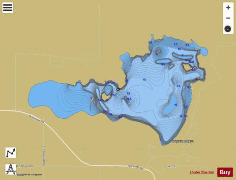
Miquelon Lakes Fishing Map Stats | |
| Title | Miquelon Lakes |
| Scale | 1:12000 |
| Districts | Division No. 10 |
| Nearby Cities | Camrose, Tofield, Beaumont, Wetaskiwin, Lamont, Fort Saskatchewan, Millet, Edmonton, Leduc, Gibbons |
| Area * | 1839.12 acres |
| Shoreline * | 13.38 miles |
| Min Longitude | -112.96 |
| Min Latitude | 53.24 |
| Max Longitude | -112.88 |
| Max Latitude | 53.27 |
| Edition Label 1 | |
| Edition Label 2 | |
| Edition Label 3 | |
| Id | CA_AB_miquelon_lakes |
| Country | CA |
| Projection | Mercator |
| * some Stats may include nearby/connecting waterbodies | |
|