McKay Lake fishing map is included in Ontario Lakes nautical charts folio. It is available as part of iBoating : Canada Marine & Fishing App (now supported on multiple platforms including Android, iPhone/iPad, MacBook, and Windows(tablet and phone)/PC based chartplotter. ).
With our Lake Maps App, you get all the great marine chart app features like fishing spots, along with McKay Lake depth map. The fishing maps app include HD lake depth contours, along with advanced features found in Fish Finder / Gps Chart Plotter systems, turning your device into a Depth Finder. The McKay Lake Navigation App provides advanced features of a Marine Chartplotter including adjusting water level offset and custom depth shading. Fishing spots and depth contours layers are available in most Lake maps. Lake navigation features include advanced instrumentation to gather wind speed direction, water temperature, water depth, and accurate GPS with AIS receivers(using NMEA over TCP/UDP). Autopilot support can be enabled during ‘Goto WayPoint’ and ‘Route Assistance’.
Now i-Boating supports Fishing Points in McKay Lake.
Have more questions about the Nautical Chart App? Ask us.
Fishing Info for McKay Lake
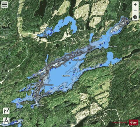
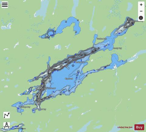
McKay Lake is a lake in Lake Superior drainage basin in the east part of Thunder Bay District in northwestern Ontario, Canada and the source of the Pic River. The northeast tip of the lake is 2 kilometres (1.2 mi) southwest of the Canadian National Railway mainline, 15 kilometres (9 mi) south of Ontario Highway 11 and 17 kilometres (11 mi) west of the community of Caramat. The lake is 19 kilometres (12 mi) long and 6 kilometres (4 mi) wide and lies at an elevation of 321 metres (1,053 ft). The primary inflows are (counterclockwise from the Pic River outflow): the Pout River at the southeast; an unnamed creek from Little McKay Lake at Yankee Bay at the north; and Sandlink Creek at Northeast Bay at the northeast. The primary outflow is the Pic River at Outlet Bay at the southeast tip of the lake, controlled by the McKay Lake Dam. Big Island in the centre of the lake is surrounded by the North, Morrin, South and West Channels. Other named bays include Boot Bay and Portage Bay at the southwest and Reedy Bay at the east.
More on Wikipedia...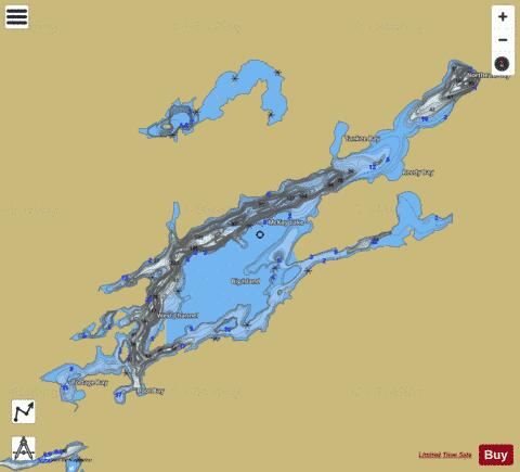
McKay Lake Fishing Map Stats | |
| Title | McKay Lake |
| Scale | 1:24000 |
| Districts | Thunder Bay |
| Nearby Cities | Longlac, Geraldton, Manitouwadge, Marathon |
| Area * | 7526.31 acres |
| Shoreline * | 78.84 miles |
| Min Longitude | -86.55 |
| Min Latitude | 49.55 |
| Max Longitude | -86.33 |
| Max Latitude | 49.66 |
| Edition Label 1 | |
| Edition Label 2 | |
| Edition Label 3 | |
| Id | CA_ON_V_103412182 |
| Country | CA |
| Projection | Mercator |
| * some Stats may include nearby/connecting waterbodies | |
|