Bearskin Lake fishing map is included in Ontario Lakes nautical charts folio. It is available as part of iBoating : Canada Marine & Fishing App (now supported on multiple platforms including Android, iPhone/iPad, MacBook, and Windows(tablet and phone)/PC based chartplotter. ).
With our Lake Maps App, you get all the great marine chart app features like fishing spots, along with Bearskin Lake depth map. The fishing maps app include HD lake depth contours, along with advanced features found in Fish Finder / Gps Chart Plotter systems, turning your device into a Depth Finder. The Bearskin Lake Navigation App provides advanced features of a Marine Chartplotter including adjusting water level offset and custom depth shading. Fishing spots and depth contours layers are available in most Lake maps. Lake navigation features include advanced instrumentation to gather wind speed direction, water temperature, water depth, and accurate GPS with AIS receivers(using NMEA over TCP/UDP). Autopilot support can be enabled during ‘Goto WayPoint’ and ‘Route Assistance’.
Have more questions about the Nautical Chart App? Ask us.
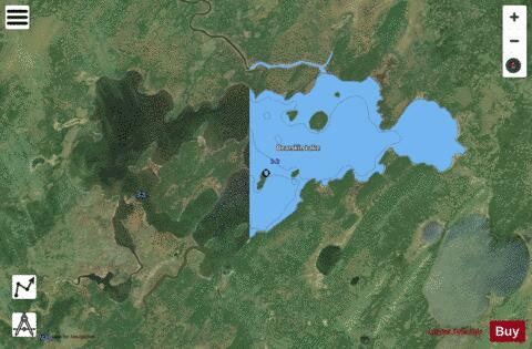
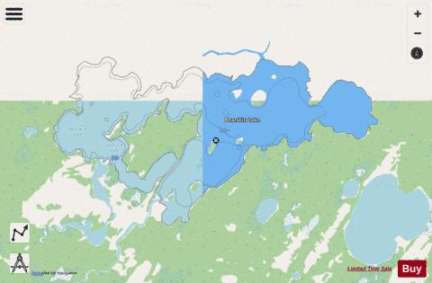
Fishing Info for Bearskin Lake
Bearskin Lake is a lake in Kenora District in northwestern Ontario, Canada. It is in the Hudson Bay drainage basin. The main inflow is the Morrison River at the south. Two other unnamed inflows are at the south (east of the Morrison River) and southeast. The major outflow, at the north, is also the Morrison River, which flows via Sachigo Lake, the Sachigo River and the Severn River to Hudson Bay. The lake was the original home of the Bearskin Lake First Nation until it moved to Michikan Lake, 50 kilometres (31 mi) to the northeast, in the 1930s.
More on Wikipedia...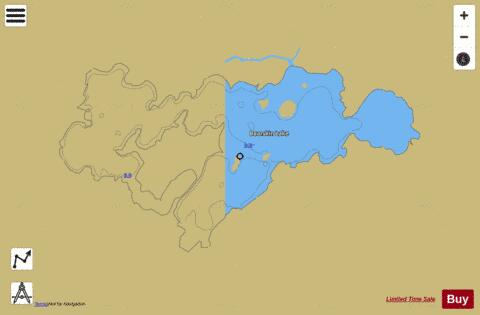
Bearskin Lake Fishing Map Stats | |
| Title | Bearskin Lake |
| Scale | 1:24000 |
| Districts | Kenora |
| Area * | 6009.06 acres |
| Shoreline * | 39.01 miles |
| Min Longitude | -91.77 |
| Min Latitude | 53.71 |
| Max Longitude | -91.61 |
| Max Latitude | 53.76 |
| Edition Label 1 | |
| Edition Label 2 | |
| Edition Label 3 | |
| Id | CA_ON_V_103404901 |
| Country | CA |
| Projection | Mercator |
| * some Stats may include nearby/connecting waterbodies | |
| |||||||||||||||||||||||||||||||||||||||||||||||||||||||||||||||||||||||||||||||||||||||||||||||||||||||
|