Daisy Lake fishing map is included in Ontario Lakes nautical charts folio. It is available as part of iBoating : Canada Marine & Fishing App (now supported on multiple platforms including Android, iPhone/iPad, MacBook, and Windows(tablet and phone)/PC based chartplotter. ).
With our Lake Maps App, you get all the great marine chart app features like fishing spots, along with Daisy Lake depth map. The fishing maps app include HD lake depth contours, along with advanced features found in Fish Finder / Gps Chart Plotter systems, turning your device into a Depth Finder. The Daisy Lake Navigation App provides advanced features of a Marine Chartplotter including adjusting water level offset and custom depth shading. Fishing spots and depth contours layers are available in most Lake maps. Lake navigation features include advanced instrumentation to gather wind speed direction, water temperature, water depth, and accurate GPS with AIS receivers(using NMEA over TCP/UDP). Autopilot support can be enabled during ‘Goto WayPoint’ and ‘Route Assistance’.
Now i-Boating supports Fishing Points in Daisy Lake.
Have more questions about the Nautical Chart App? Ask us.
Fishing Info for Daisy Lake
Daisy Lake is a lake in the geographic townships of Butt and McCraney in the Unorganized South Part of Nipissing District, Ontario, Canada. The lake is in the Ottawa River drainage basin and is entirely within Algonquin Provincial Park. The lake is about 4.2 kilometres (2.6 mi) long and 1.5 kilometres (0.9 mi) wide, lies at an elevation of 442 metres (1,450 ft), and is located about 14 kilometres (9 mi) northeast of the community of Kearney. There are three named inflows, the Petawawa River at the north (just downstream of that river's source at Ralph Bice Lake), Hambone Creek at the northwest and Casey Creek at the southwest, and one unnamed creek inflow at the west. The primary outflow is also the Petawawa River, which flows out of the east of the lake to the Ottawa River.
More on Wikipedia...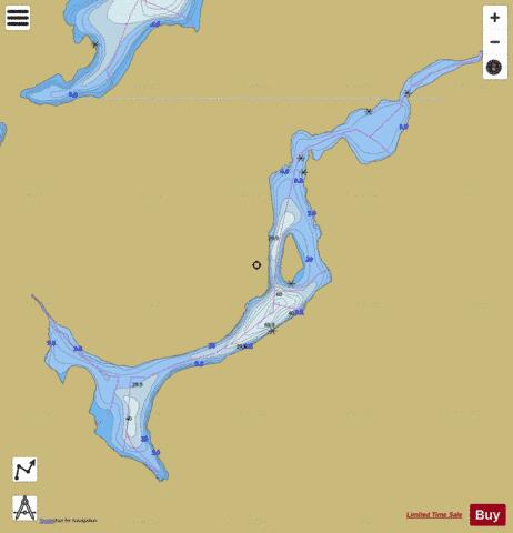
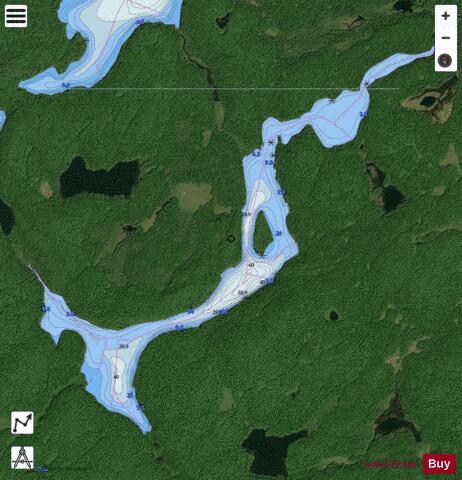
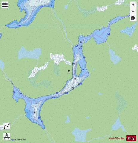
Daisy Lake Fishing Map Stats | |
| Title | Daisy Lake |
| Scale | 1:12000 |
| Districts | Nipissing |
| Nearby Cities | Huntsville, Powassan, Mattawa, Bracebridge, Haliburton Village, North Bay, Gravenhurst |
| Area * | 325.18 acres |
| Shoreline * | 9.20 miles |
| Min Longitude | -78.97 |
| Min Latitude | 45.65 |
| Max Longitude | -78.92 |
| Max Latitude | 45.68 |
| Edition Label 1 | |
| Edition Label 2 | |
| Edition Label 3 | |
| Id | CA_ON_V_103380118 |
| Country | CA |
| Projection | Mercator |
| * some Stats may include nearby/connecting waterbodies | |
|