Calling Lake fishing map is included in Alberta Lakes nautical charts folio. It is available as part of iBoating : Canada Marine & Fishing App (now supported on multiple platforms including Android, iPhone/iPad, MacBook, and Windows(tablet and phone)/PC based chartplotter. ).
With our Lake Maps App, you get all the great marine chart app features like fishing spots, along with Calling Lake depth map. The fishing maps app include HD lake depth contours, along with advanced features found in Fish Finder / Gps Chart Plotter systems, turning your device into a Depth Finder. The Calling Lake Navigation App provides advanced features of a Marine Chartplotter including adjusting water level offset and custom depth shading. Fishing spots and depth contours layers are available in most Lake maps. Lake navigation features include advanced instrumentation to gather wind speed direction, water temperature, water depth, and accurate GPS with AIS receivers(using NMEA over TCP/UDP). Autopilot support can be enabled during ‘Goto WayPoint’ and ‘Route Assistance’.
Now i-Boating supports Fishing Points in Calling Lake.
Have more questions about the Nautical Chart App? Ask us.
Fishing Info for Calling Lake
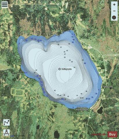
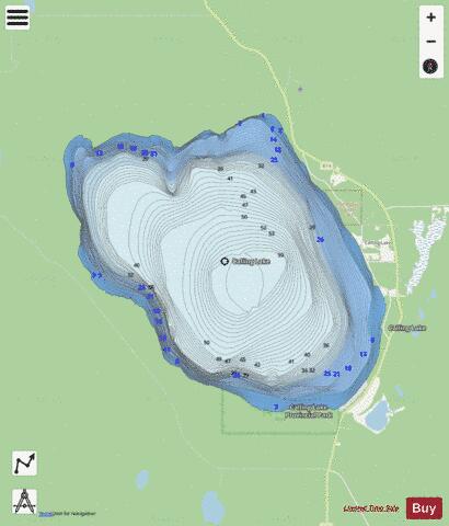
Calling Lake is a large lake in north-central Alberta, Canada. The lake's name comes from the First Nations of the area, who heard the lake ice cracking. It has a total area of 134 km2 (52 sq mi) and is located in a large bend of the Athabasca River, 60 km north of the town of Athabasca on Highway 813. The Calling Lake Provincial Park is located on the southern shore of the lake, and the Jean Baptiste Gambler 183 First Nations reserve of the Bigstone Cree Nation is established in the hamlet of Calling Lake on the eastern shore. The waters of the lake are drained through the Calling River into the Athabasca River.
More on Wikipedia...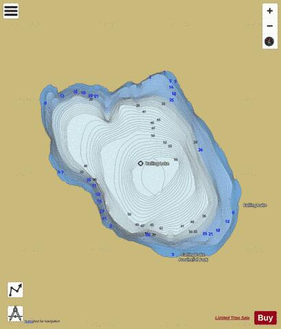
Calling Lake Fishing Map Stats | |
| Title | Calling Lake |
| Scale | 1:24000 |
| Districts | Division No. 17 |
| Nearby Cities | Athabasca |
| Area * | 34308.06 acres |
| Shoreline * | 30.89 miles |
| Min Longitude | -113.43 |
| Min Latitude | 55.18 |
| Max Longitude | -113.19 |
| Max Latitude | 55.30 |
| Edition Label 1 | |
| Edition Label 2 | |
| Edition Label 3 | |
| Id | CA_AB_calling_lake_ab |
| Country | CA |
| Projection | Mercator |
| * some Stats may include nearby/connecting waterbodies | |
|